by jhwildlife | Jul 7, 2019
Respecting Winter Closures – Don’t Poach the Powder and Help Jackson Hole’s Wildlife Survive the Winter
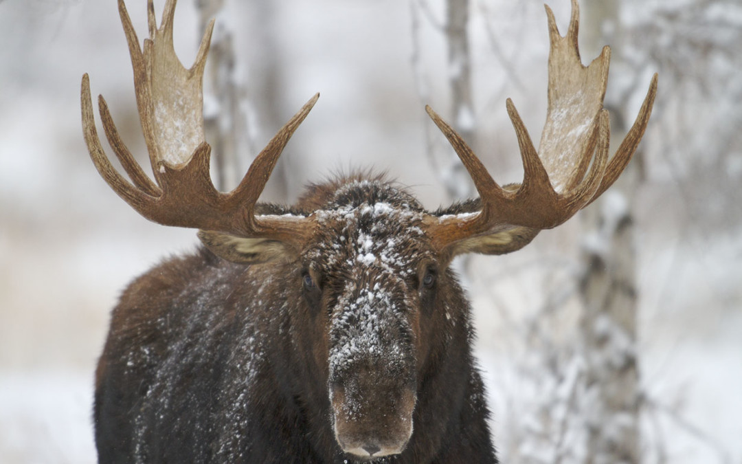
We may be desperate for snow, but recreating in winter wildlife closure areas is not the way to find it. That’s the message several government agencies, environmental groups and recreation clubs hope to spread this winter through the “Don’t Poach the Powder” campaign. The groups want to let residents and visitors know that “poaching” wildlife closures with skis, snowboards or snowmobiles can be as harmful to wildlife populations as poaching with a rifle.
The Jackson Hole Wildlife Foundation has a unique partnership with the Bridger-Teton National Forest, the Jackson Hole Conservation Alliance, the Wyoming Game and Fish Department, the Wyoming State Snowmobile Association, the Teton Conservation District, and the Wyoming State Trails Program to help end a harmful practice that continues despite Jackson’s environmentally conscious constituency.
Why is it harmful to violate winter range closures?
Human presence stresses wildlife, causing them to use precious energy they need to survive until summer.
Deep snow, cold temperatures, and a lack of food make winter a stressful time for wildlife.
Large ungulates such as elk, mule deer, moose and bighorn sheep rely on wind-swept south facing hillsides for winter food.
What can you do to help?
Respect wildlife and their habitat by knowing the location of closed areas before entering the Forest and avoid wildlife winter range. Closures are in effect from December 1 – April 30. Access the USFS closure map here.
Obtain a free winter travel map from any Forest Service office or the visitor center on North Cache.
Help spread the word about winter closures with your friends. Many of the violations are not intentional and could be avoided if the people knew where the closure areas were located.
Obey the closures even when the snow is beginning to melt and dry areas are exposed. Hikers, paragliders, horseback riders and bicyclists can have the same dire impacts on weakened wildlife just coming out of the winter season. Spring is an important time for wildlife to restore depleted energy resources.
Stop at the information kiosk at major Forest Trailheads. The winter closure maps and information is generally posted in these areas as well.
Report offenders to the individual agencies responsible for enforcement (e.g. Grand Teton National Park, Bridger-Teton National Forest, Targhee National Forest).
by jhwildlife | Jul 6, 2019
Click here to access the 2018 Float Trip Summary Report
Click here to access the 2017 Float Trip Summary Report
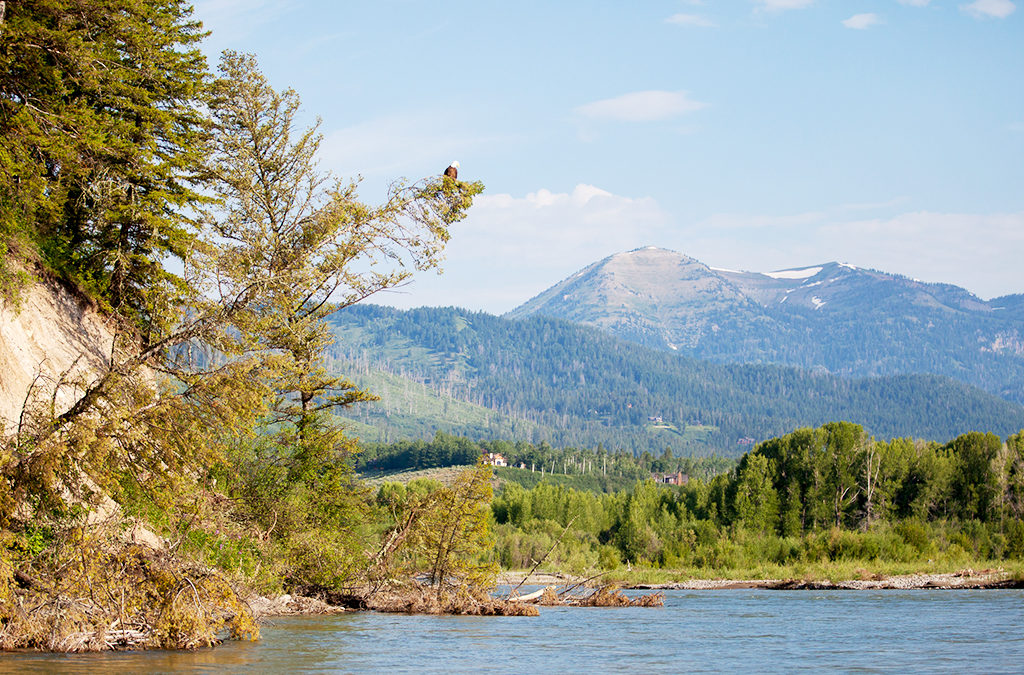
The Snake River Float Project is designed to gain a better idea of what species of mammals, birds and amphibians use the section of river between Wilson Bridge and South Park. In this section, the river flows mostly through private land where wildlife professionals do not conduct a systematic census.
The Snake River Float project helps to provide a more complete picture of the species that use the river corridor between Wilson Bridge and South Park. It has recorded the locations of nests of osprey, bald eagle, and great blue heron, along with ducks and shorebird nesting areas. This project has recorded thousands of individual birds. Mammals observed range from least chipmunk to moose.
The float also provides a wonderful opportunity to enjoy AJ DeRosa’s wooden boat adventures. AJ’s Jackson Hole Vintage Adventures generously offers this opportunity in support of our citizen science program.
by jhwildlife | Jul 11, 2018
Read the 2017 report here.
Read the 2016 report here.
Read the 2015 report here.
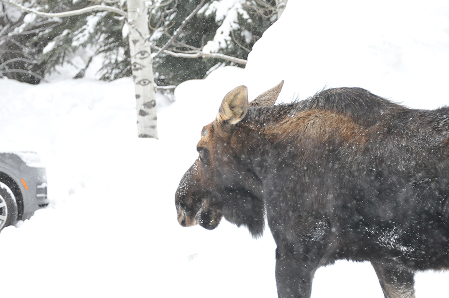
Certified citizen scientists of Nature Mapping Jackson Hole track moose on pre-assigned parcels on Moose Day – an annual survey conducted in collaboration with the Wyoming Game and Fish Department (WGFD), Grand Teton National Park, and the Bridger-Teton National Forest. Teams of two or three people get an assigned territory in areas that are difficult for the WGFD to survey (mostly near private lands or adjacent to more developed areas) and record moose observations. These collected data contribute to monitoring moose population trends in Jackson Hole over time. A winter’s day searching the valley for moose is one of many exciting Nature Mapping Jackson Hole projects that connect members of the community to one another and to our wild lands.
by jhwildlife | Jul 9, 2018
Click here for the Mountain Bluebird trail nestbox monitoring guide
Click here for the Mountain Bluebird “resighting” data sheet
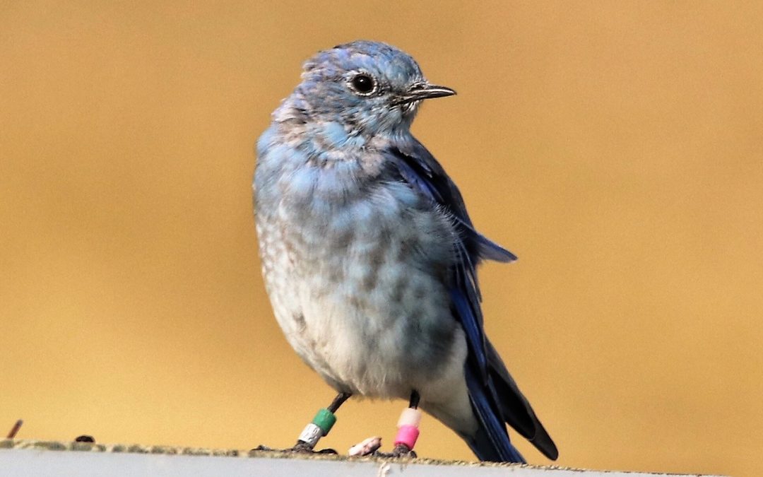
In 2017, bander Allison Swan and monitoring volunteers began placing USGS aluminum bands as well as a unique series of color bands on each of 98 Mountain Bluebird nestlings and one adult female. That will allow us to view and identify each individual returning bird and to follow along as it hopefully raises some little bluebirds of its own!
What’s more, banding these birds will provide new data, expanding on over 15 years of nestbox monitoring data and helping to answer questions related to survival rates of young, dispersal patterns, re-nesting rates, productivity by age and other elements of population dynamics.
Staff and volunteers are working to gather these data by resighting color banded bluebirds, or “Bluebirds with Bling,” but we would love your help!
by jhwildlife | Jan 10, 2018
Data Requests
One of the primary goals of Nature Mapping is to provide data to decisions makers, research organizations and agency personnel in an effort to support informed decisions that will be beneficial to wildlife and “keep common wildlife common”.
If you are interested in requesting data from Nature Mapping Jackson Hole, please fill out the information found on this PDF data request form and submit it to kate@jhwildlife.org. We will be in touch with any questions. All data requests are reviewed by the Nature Mapping Advisory Committee. This board meets once a month and retains the ability to fulfill or deny requests based on our guidelines.
Please address all questions and concerns regarding data requests to the Jackson Hole Wildlife Foundation at 307-739-0968 or kate@jhwildlife.org.
Data Request Process – How it Works
- Requester submits a data request using our electronic form below. Please fill out this form as completely as possible and explicitly tell us why you are requesting Nature Mapping data.
- Nature Mapping Advisory Committee reviews the data request at their monthly meeting.
- If the request is approved, the requester will sign a data release agreement with Nature Mapping/ JHWF (sample below).
- Data will be delivered electronically as either a shapefile or Microsoft Excel document.
- Requester’s end products will be delivered to Nature Mapping/ JHWF per the timeline outlined in the data request form.
- The intent is for wildlife to benefit from this cooperative agreement.