The following is a story from Nature Mapping Jackson Hole. Citizen science is valuable because it engages community members in long-term data collection. Through the process of becoming involved in a monitoring project like Nature Mapping JH, folks learn more about their world, while contributing meaningful data that can have a broader impact.
In December of 2021, I received a phone call from a Nature Mapper who lives in the Rafter J Neighborhood. She was wondering if Nature Mapping data showed any strong trends in wildlife use of the area. Unfortunately, there was not enough data in the neighborhood to show any kind of trends, but I encouraged the person to continue Nature Mapping and to have her friends and neighbors email me if they were interested in contributing. So started my friendship with Gina Lipp, a neighbor of the person who had called, who soon reached out with interest in the Nature Mapping program. A resident of Rafter J since 1984 and wildlife enthusiast, Gina wanted to contribute data to further understand how wildlife use the Rafter J Neighborhood.
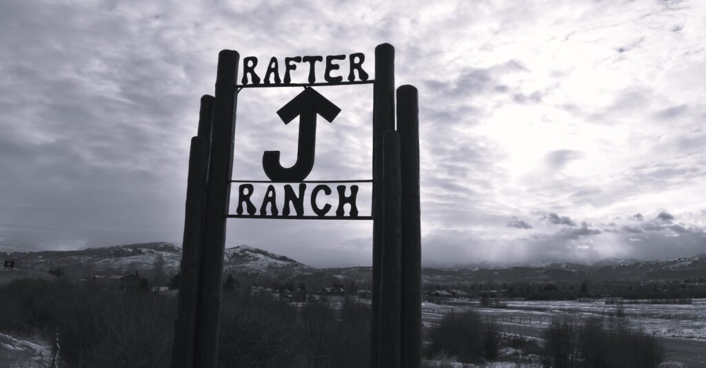
The Rafter J neighborhood south of Jackson was developed in the 1980s and early 90s. Wildlife corridors through the neighborhood and a thriving Flat Creek riparian habitat have made it a place that many wild animals can call home, alongside their human neighbors.
Gina took my virtual Nature Mapping training in Jan of 2022. About a week after the training, she photographed a Great Gray Owl in the neighborhood, and made one of her first Nature Mapping observations. After this, she reached out to me regularly with questions about the variety of wildlife she was seeing in her neighborhood. She had a camera, so had photos of everything and I was able to help her with identification over email. However, I am a firm believer in the “Teach a person to fish” philosophy, so I offered to meet Gina down at Rafter J and go for a walk to help with some of her bird and wildlife ID questions. As many know, my interest and skill set are geared towards birds, which are one of the most ubiquitous and accessible groups of wildlife, yet relentlessly underappreciated in the Greater Yellowstone Ecosystem (GYE).
Hilary and Gina began recording Nature Mapping observations in early 2022. Documenting wildlife sightings over a three-mile walking route approximately twice per month, Gina has contributed to citizen-science by making well over 700 wildlife observations in her neighborhood.
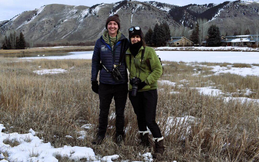
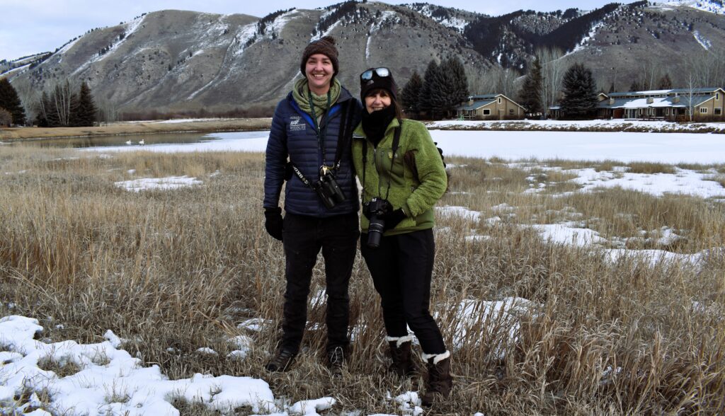
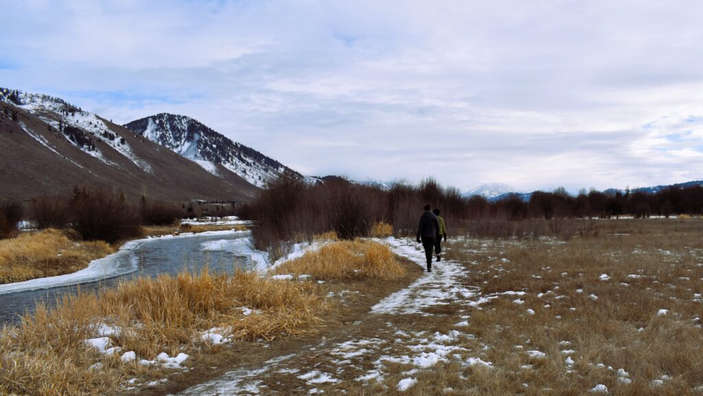
I met Gina on a chilly morning in early February of 2022. We started off on our birding walk from the Rafter J office and almost immediately spotted Green-winged Teal in the shallow sloughs of Flat Creek. Farther down the road, some small birds flushed from the ground into the willows. As I lifted my binoculars, a sense of excitement passed over me; the birds were American Tree Sparrows! These adorable songbirds nest in far northern Canada and Alaska and are only present in the GYE during winter. As hardy as they are, they can be very difficult to find during the coldest months of winter in Jackson. Yet here were three individuals, making a living in the Rafter J neighborhood in mid-February. We ended up finding 13 species of birds together that cold morning. Gina Nature Mapped everything we saw and we parted ways, happier for having enjoyed the wildlife in the suburban neighborhood together that morning.
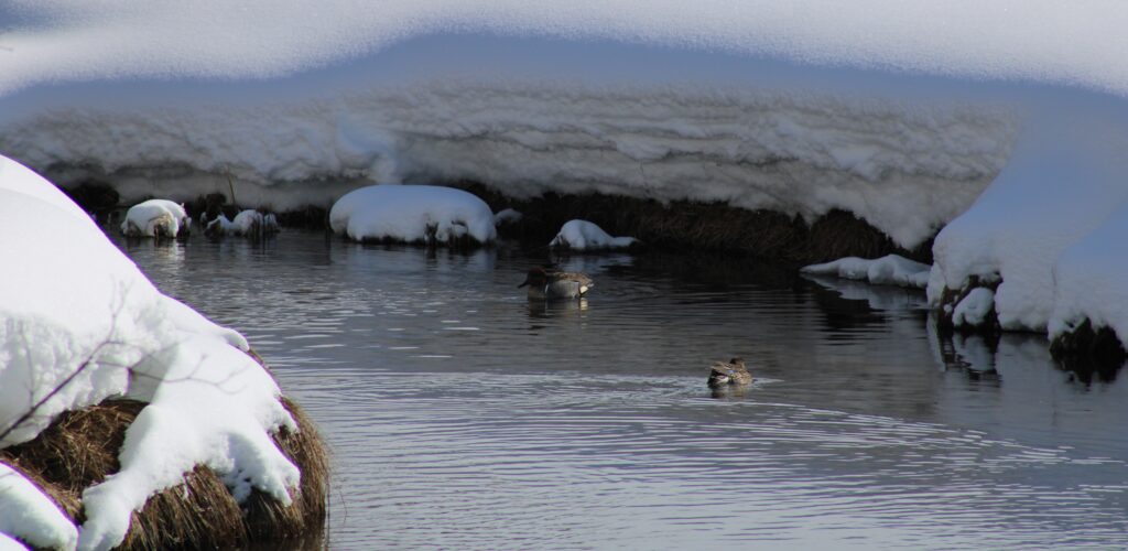
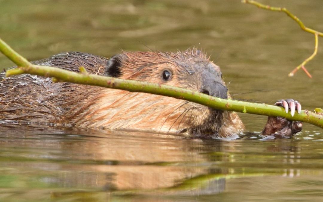
Green-winged Teal photographed on Flat Creek in mid-winter. Green-winged Teal are a dabbling duck found year-round in the Jackson area. Photo: Gina Lipp.
The next year went by and Gina continued to collect data in the neighborhood, but I noticed her reports became fewer and fewer throughout the year. This reduction in reporting is typical with Nature Mappers but I had seen Gina’s enthusiasm and thought if I continued to engage with her, perhaps she would continue reporting. At the start of 2023, I emailed her about the new Nature Mapping app and asked her if she would like to walk again in Rafter J to reinvigorate her Nature Mapping. A clear morning, free of snow, finally arrived and we walked again, this time digging up 18 species. Our list included an American Dipper using Flat Creek and a flock of Bohemian Waxwings relishing the leftover fruit of a crabapple tree in the neighborhood. I told Gina that we should aim to walk again in April, to see what we could find as spring migration got underway. My goal was to understand how birds use the neighborhood during different times of year and I knew Gina was also excited about this.
The local homeowner’s association controls much of the land along Flat Creek through Rafter J, creating a defacto “development setback.” Native vegetation within the riparian zone along the creek allows the area to retain ecological functionality. Birds, mammals (including people!), reptiles, and amphibians all make use of the habitat along the creek.
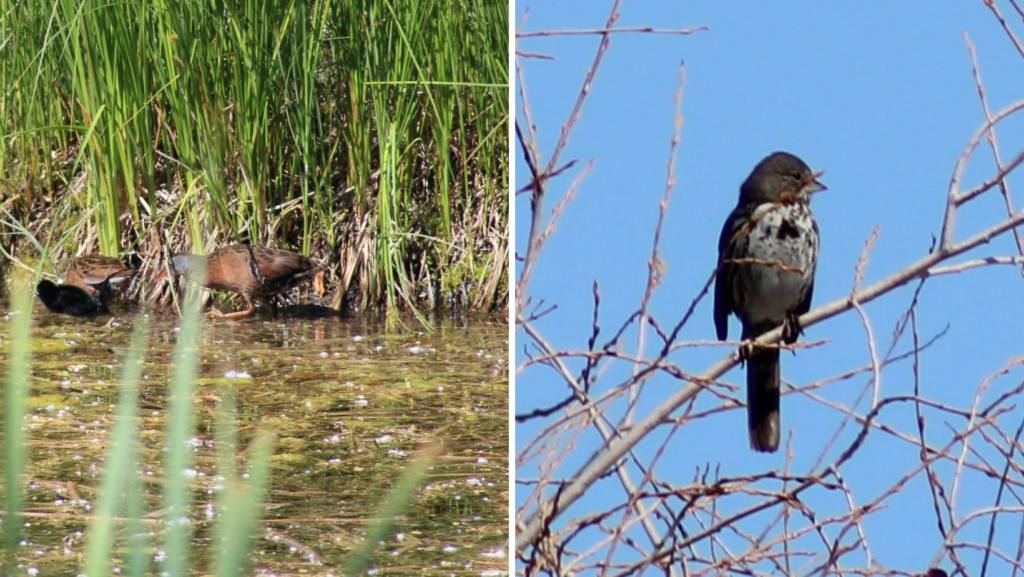
April came and so did the birds. I was stoked to see what had arrived and to my delight, the Osprey pair were already fixing up their nest for another round of raising chicks atop a platform installed by the neighborhood near Flat Creek. A pair of Northern Harriers coursed low over the open space near the wetland habitat restoration area in the middle of Rafter J. I wondered aloud if they might be breeding in the neighborhood. We spotted eight species of waterfowl using the creek and ponds as stopover habitat during their spring migration. I became ecstatic when I heard a Virginia Rail kiddick-ing from the cattails of the restoration area. A Fox Sparrow sang its glorious tune from the willows along Flat Creek. Tree Swallows investigated nestboxes and I was thrilled to detect five finch species as we meandered through the neighborhood. Our three mile walk yielded an incredible 37 species of birds on April 28. I made plans with Gina to walk again in June, this time to assess the community of breeding birds present in the Rafter J neighborhood.
April sightings included elusive Virginia Rails and their chicks (left) in the habitat restoration pond and a Fox Sparrow (right) along the creek. Photos: Gina Lipp.
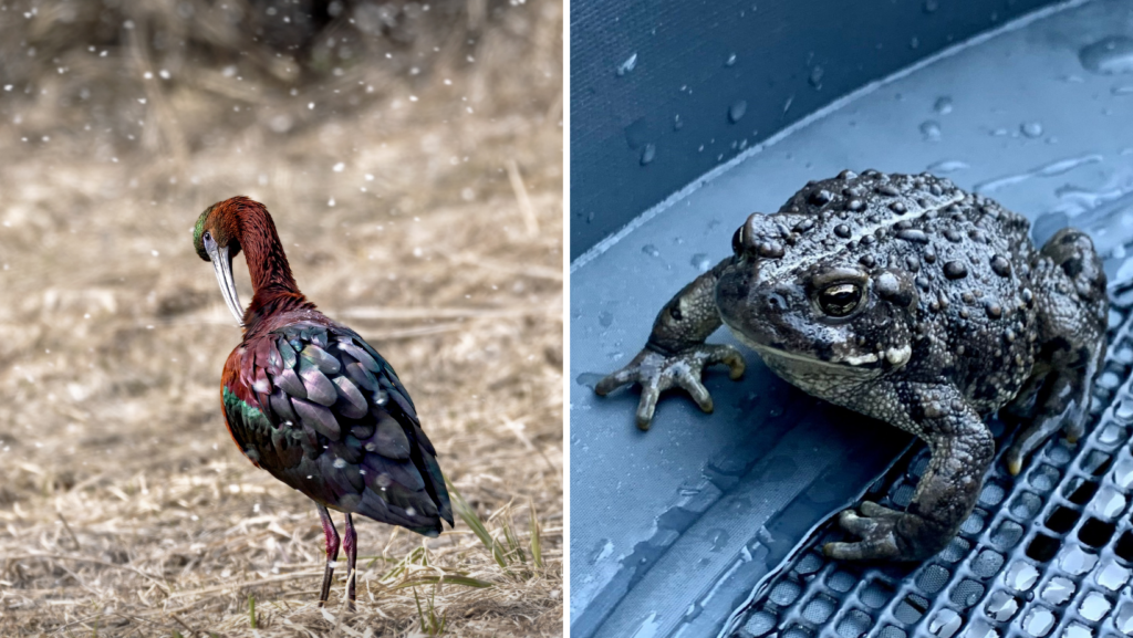
Gina continued Nature Mapping on her own as well. Everything she reported was easily verifiable with photo documentation. She observed a variety of wildlife using the Flat Creek Corridor and wetland habitat, including beaver, muskrat, moose, coyote and boreal chorus frog. Other members of the neighborhood community became involved as well. Local photographer and JHWF supporter Anna Knaeble became trained in 2023 and mapped Northern river otter and Western toad in Rafter J, both Wyoming Species of Greatest Conservation need and species that are Nature Mapped in relatively low densities in Teton County. Many Rafter J neighbors became excited when a group of White-faced Ibis dropped into a flooded open space of the neighborhood for a few days to refuel during spring migration. The neighbors recognized the importance of the open space in their neighborhood when they observed the birds utilizing it in this way.
White-faced Ibis and Western toad, both Species of Greatest Conservation Need in Wyoming. Some ibis stopped by to dazzle residents during its spring migration, taking advantage of flooded pasture along Flat Creek near the entrance to Rafter J. Photos: Anna Knaeble.
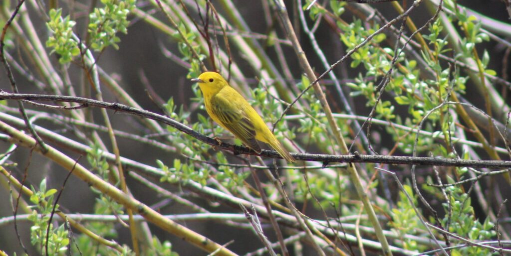
In June, Gina and I returned to our walking route. Indeed, the avifauna had changed again; the breeding season was now in full swing! The dawn chorus included Savannah Sparrows chiming from the edges of the neighborhood, Black-headed Grosbeaks sweetly serenading from the willows, and Bullock’s Orioles chattering from the tops of residential cottonwoods. Male Calliope Hummingbirds zipped around defending territories with their impressive aerial displays and American Robins carried food to young in nests. Many fewer waterfowl were present, as most had continued their journeys to northern breeding grounds, but we heard another Virginia Rail and Gina spotted a Sora this time. These two rail species do not usually persist outside of intact marsh habitat and their presence during the breeding season is indicative of a functioning wetland ecosystem within the Rafter J neighborhood! Willow Flycatchers sang from the Flat Creek Corridor and we watched a sweet female Yellow Warbler building her nest, low in the willows. We documented 43 bird species on this walk, confirming a robust suite of breeding songbirds in the neighborhood.
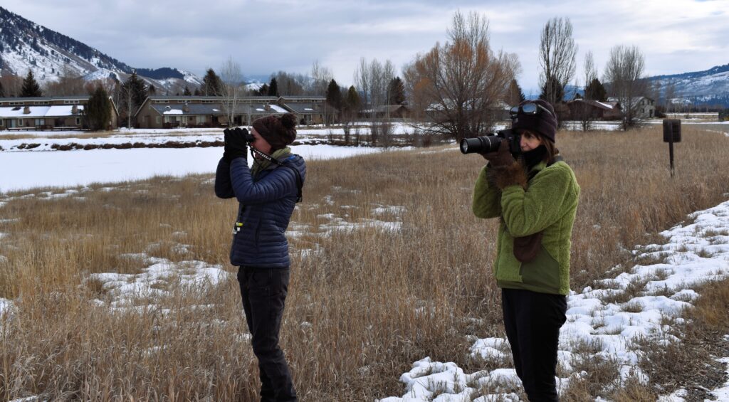
Gina and Hilary watch and photograph waterfowl on a Rafter J pond. This pond is believed to be geothermally heated which keeps portions of it ice-free throughout the winter. Waterfowl such as Trumpeter Swans, Barrow’s Goldeneye, and Mallards make use of the open water.
August rolled around and once again I contacted Gina. This time, I wanted to see what was starting to move south. Fall is my favorite time to go birding in the West and believe it or not, late August is the start of peak fall migration. I knew our walk was going to be great this time. Following the breeding season, there is simply more avian biomass on the landscape and because so many of the birds are young, the likelihood of finding something unusual increases by quite a bit. We met on August 28 and it was foggy to start. Initially, I was bummed at the conditions, but as the sun started to cut through the fog, Rafter J came alive with activity. A Lincoln’s Sparrow skulked in the willows, popping out to allow us brief looks. A Western Wood-Pewee sallied out over Flat Creek, capturing insects and returning to its perch long enough for Gina to photograph it. We encountered six warbler species, a decent number for a single location-outing in Jackson. A Swainson’s Hawk circled overhead, preparing for its annual journey to Argentina. Ruby-crowned Kinglets alerted us to their presence with their chiddit call notes and Cedar Waxwings swirled throughout the neighborhood with their newly fledged young. It was the best outing yet – we detected 54 species throughout the neighborhood that day!
In August, Hilary and Gina record six warbler species on their walk, including this Yellow Warbler. Yellow Warbler is the most common warbler in Jackson during summer months, and can be found without too much work in a variety of habitats, from willows, to wet thickets, to open woodlands. Photo: Gina Lipp.
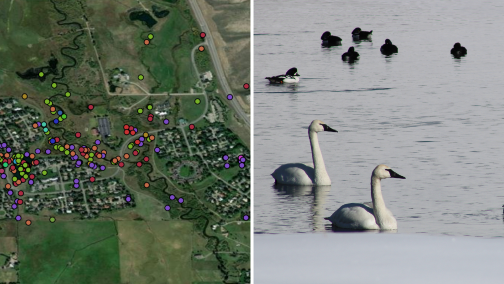
During our five walks, Gina and I documented a whopping 83 bird species in Rafter J! Even better for me, however, was watching Gina become a keen observer of nature as she grew her knowledge of Jackson’s wildlife. She improved vastly in her wildlife identification skills since our first outing and she also found some amazing things. In mid-July, she witnessed a Virginia Rail emerge from the cattails in the habitat restoration area and then another, followed by two small black fuzzballs – baby Virginia Rails! We suspected they were breeding at the site, but now had ironclad evidence. Since Jan 2022, Gina has made over 700 wildlife observations in her neighborhood. Mapping her three-mile walking route approximately twice per month, her wildlife observations have exact locations, showing where wildlife use the landscape in the neighborhood. Her hard work over the last two years has breathed new life into the Nature Mapping database in the Rafter J neighborhood. Although Gina is dedicated, she is not alone. Since 2016, Rafter J residents have Nature Mapped 118 species in the neighborhood, including 20 Species of Greatest Conservation Need, a state-level designation by Wyoming Game and Fish Department (WSGCN).
Occurrences of Wyoming Species of Greatest Conservation Need (WSGCN) near Rafter J are shown with colored dots (left). Trumpeter Swans (right) are an example of a WSGCN and utilize the Rafter J pond and nearby wetlands as seasonal habitat and during migration (SEE SWAN SIGHTINGS MAP). Photo: Gina Lipp.
As more development occurs to meet the needs of the growing community, we have a responsibility to consider those who have no voice. Nature Mapping data can give wildlife a voice. The picture we now have of landscape use by wildlife in the Rafter J neighborhood can inform responsible development along Flat Creek, such as Northern South Park, and other areas. Through the data Gina and others have collected in Rafter J, we see that robust development setbacks from Flat Creek and wildlife corridors through the neighborhood have made it a place that many wild animals can call home, alongside their human neighbors. Nature Mapping data show that the neighborhood’s riparian corridor and wetland complex are healthy enough to sustain a very nice suite of riparian breeding songbirds during the summer and make it one of the most bird-rich areas in Jackson Hole in the winter.
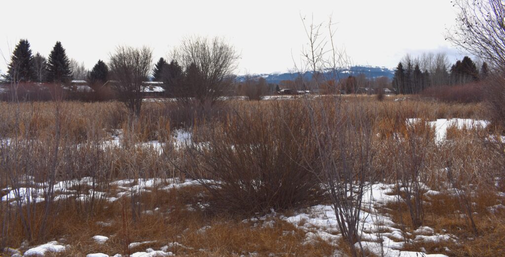
Emergent wetland of the habitat restoration area adjacent to Flat Creek form a valuable habitat type for species like Northern Harrier, Sora, and Virginia Rail, all of which Hilary and Gina spotted here. Sora and Virginia Rail rarely occur outside of intact marsh environments such as this one.
Rafter J residents are fortunate to live alongside such a healthy community of wildlife, but this also comes with the responsibility of stewardship as neighbors to wildlife. Young wild animals are extremely vulnerable to predation by domestic animals like cats and dogs. Keeping cats indoors and leashing dogs while walking through the neighborhood are simple ways to protect the wildlife that also call this space home. Both grizzly and black bears have been documented in Rafter J. Use of bear-resistant trash containers and securing other attractants can be the difference between life or death for these animals. Making conservation-minded decisions, even in a small neighborhood, can have many far-reaching and positive impacts!
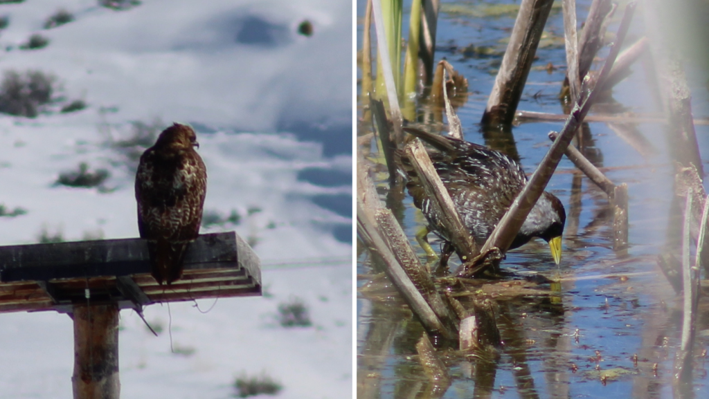
A Red-tailed Hawk perches on a nesting platform on the east side of Rafter J (left). A secretive Sora was a surprise find by Gina in the habitat restoration pond in the summer of 2022. Photos: Gina Lipp.
Gina’s work in the Rafter J neighborhood shows that with commitment and dedication, Nature Mapping can illustrate the complete annual cycle of wildlife – even in developed areas! And if data are rigorously collected, they can sometimes be used to inform responsible development and aid in wildlife conservation.
I asked Gina to speak to the importance of Nature Mapping and this is what she said, “Living in the Greater Yellowstone Ecosystem is a blessing and a responsibility. With all its beautiful wildlife, there is no other place like it in all of North America. Nature Mapping is so important to help us recognize, learn, appreciate, and protect the wildlife and their habitat.”
Jackson Hole Wildlife Foundation is excited to announce a new partnership with beaver researcher and hydrologist Jeff Burrell and a new project for interested Nature Mappers – Beaver Project! In Beaver Project, Nature Mappers will provide information about beaver sign they detect on the landscape in the Jackson Hole area. Read on for more information about Beaver Project from Jeff:
It is well documented that beavers provide a wide range of ecosystem services including benefits for water quality, water quantity, and fish and wildlife habitat. Beavers also make ecosystems more resilient to the impacts of climate change. These benefits include reducing peak stream flows, and so limiting erosion and damaging flashfloods; improving drought resilience and increasing ecologically beneficial natural water storage; stabilizing water temperatures; and creating/maintaining fire breaks and refugia from fires.
“More than ever, we need beavers doing what they do so well, but they need our help. Information provided by citizen scientists will help wildlife managers understand where beavers are on the landscape and what services they are providing. In Beaver Project we will gather this information by a simple process of field surveys and observations. Beavers leave behind a record of where they are or were active, and what they are or were doing. So not only can we learn about where they are now but where they were active in past. This will help us understand trends in beaver activities so federal and state agencies as well as private landowners can take actions to help ensure beaver conservation and restoration.”
Beaver Project Protocol:
Email hilary@jhwildlife.org to be added to Beaver Project in your Nature Mapping account. Not a trained Nature Mapper? Email hilary@jhwildlife.org to sign up for the August 24th training.
While out hiking along creeks, check waterways for beaver sign. If you see sign on the landscape, please consider Nature Mapping it.
If you see a live beaver, please use Casual Observations, rather than Beaver Project to document the sighting. Beaver Project is for sign only. If you observed a live beaver and beaver sign, you can indicate the live beaver in the notes section of the Beaver Project form.
Beaver activity indicators are conveniently grouped into the following categories. Because many beaver activity indicator persist through time, we can also group activities into current activities (within the past few months, recent activities (within the past year or two, or past activities (more than two years old).
Please view Jeff’s Beaver Sign Identification Seminar on our YouTube channel for more information.
In Nature Mapping Jackson Hole’s Beaver Project, check the boxes of all activity indicators you observe on the landscape, and their ages.
1. Clipping and girdling:
Beavers are famous for chewing wood to gather food and building materials. As they do so, beavers leave distinctive patterns of tooth marks. ‘Clipping’ means that the beaver directly chewed through the wood; ‘girdling’ means that the beaver partially chewed through the wood and then let wind and gravity do the rest.
Current: the wood has a fresh appearance (fresh wood color with sharp tooth marks)
Recent: the wood has changed to a darker color but still retains sharp markings
Past: the wood is much darker and more weathered in appearance with cracks and feathered markings
2. Food rafts, caches and feeding stations:
Beaver gather and store branches to eat (now or later). These branches will have the characteristic tooth marks of clipping and girdling, and can be grouped into age categories in the same fashion as clipping and girdling.
3. Slides:
Beavers move branches from harvest location to ponds and streams. To do so they pull the material into the water; these activities leave behind a smooth ramp in the mud adjacent to the pond or stream. These ramps are ‘beaver slides.’
Current: the slide is very smooth in appearance with few if any other animal tracks
Recent: the slide is still somewhat smooth but will likely show other animal tracks
Past: hard to distinguish between a beaver slide and animal path, but the location will help identity as a beaver slide
4. Bank dens, bank lodges and free-standing lodges
A bank den is a simple home burrowed into the stream or river bank. A bank lodge is similar to a bank den but has been reinforced by beavers building a dome of branches and mud above the burrow. A free-standing lodge is a pile of branches reinforced with mud within the pond.
Bank den: current (fresh, maintained appearance with current clipping around the entrance, recent (similar but the entrance will show some degradation and only recent clippings, past (very degraded and likely at least partially collapsed.
Bank lodge: see above but now we can use appearance of reinforcing branches and mud to categorize as current, recent and past
Free-standing lodge: current (current clipping and fresh mud piled on top of branches, recent (recent clipping and mud at least partially washed away, past (past clipping and most if not all mud washed away
5. Scent mounds:
Beaver use piles of debris (leaves and twigs) and castoreum (a glandular scent) to mark territories.
Current: fresh leave and twig appearance and scent
Recent: appearance more weathered and little if any scent
Past: likely not identifiable as a scent mound
6. Tracks and scat:
These are the most ephemeral of the indicators we will use. Mainly note if observed
Current: fresh appearance
Recent: degraded appearance
Past: unlikely to be identified
7. Canals:
Beavers excavate canals from the channel or pond to provide safe access to food resources.
Current: sharp boundaries with little vegetation overgrowth
Recent: boundaries less distinct with some vegetation over growth and partial collapse
Past: substantial over growth and collapse
8. Dams:
Since dams are for the most part constructed from branches and mud, use appearance of these
Current: fresh cut branches and mud
Recent: recent branch appearance and mud partially washed away
Past: past branch appearance and mud mostly gone
Thank you for your contributions to this important data set. We look forward to understanding more about beaver distribution in Jackson Hole from our partnership with Jeff!
As Nature Mapping Jackson Hole nears its landmark 1000th certified Nature Mapper, I thought it would be fun to write an article featuring a couple of newer Nature Mappers who were just trained in the last year. Many of you have participated in Nature Mapping and its variety of projects since its inception in 2009, but lots of new Nature Mappers have joined our ranks recently and we warmly welcome them!
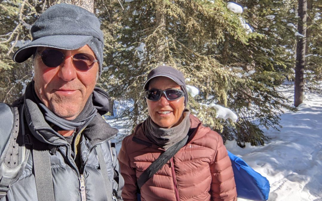
John and Kathy at Moose Day.
Kathy O’Neil and John Norton have been visiting their property in the Teton Valley since 2006 and finally made the area their home in 2020 after Kathy retired from a career as a physician specializing in women’s imaging radiology. John describes himself as “never having been career minded,” but had a variety of interesting experiences throughout his working years. He served in the US Air Force for 10 years, during which time he received an MS in Astronautical Engineering. After leaving the Air Force, he cycled across America, “married his best friend [Kathy],” and moved to Salt Lake City where he worked as a consultant for a variety of organizations.
Kathy loves living in the Teton Valley, a “beautiful community” where she has already become heavily involved in conservation and wildlife projects. She hopes to become even more involved, as she trains to become a certified Idaho Master Naturalist through the Idaho Department of Fish and Game, and continues her education through opportunities with the Jackson Hole Wildlife Foundation. Kathy and John both enjoy skiing, hiking, and viewing wildlife. John describes the GYE as “providing a canvas for doing all the things I love to do.”
The couple tuned into the virtual October 2021 Nature Mapping Certification Training together from their home in Driggs, ID. They heard about JHWF’s Nature Mapping program through the Teton Regional Land Trust, as well as involved friends, and immediately began participating in a variety of Nature Mapping projects. Both have submitted data to Casual Observations and Project Backyard as well as attending JHWF Continuing Education seminars and snowshoeing to count moose during Moose Day.
When asked what their favorite animals are, John and Kathy had very different, but equally beautiful answers. Kathy described her ex-feral Siamese cat Smudge, who she rescued. John’s favorite animal is any animal he is near that is undisturbed by his presence. To me, their answers are those of two conservation heroes. Through the action of rescuing a feral cat, Kathy saved not only the life of the cat, but also the lives of the many birds, small mammals, insects, reptiles, and amphibians the cat would have killed over the course of its life as a feral. John’s attempts to view wildlife without disturbing them means he values the safety of the animals on the landscape over his own self-interests such as viewing the animal more closely or getting a great photograph.
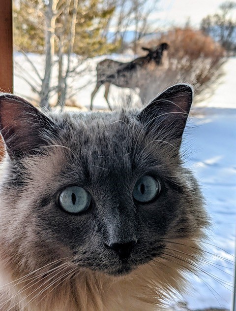
Smudge the cat.
All of the Nature Mapping projects they have participated in have been fun for the couple, but they particularly enjoyed Moose Day for the organization and collective effort by citizen scientists. They were also thrilled to participate in Casey McFarland’s tracking class and other continuing education opportunities through JHWF. Together, Kathy and John have submitted more than 100 Nature Mapping observations in a little more than half a year. John’s favorite observation was of a flock of Bohemian Waxwings that he observed this winter in the Teton Valley. He described loving the sounds they made and how the flock “moved through the sky as if it was one organism, an angel.” Kathy’s favorite observation was of a moose that she found sleeping near her bedroom window one morning this winter. She described the experience of realizing they had spent the night only 15 feet apart as one she will not forget.
The couple participate in citizen science because they desire to give back to the wildlife they love. John says, “we share this planet with life forms that modern society has learned to completely ignore, abuse, and destroy.” Through citizen science, he hopes to bring more awareness to these issues. Kathy appreciates that the data she provides will “help policy makers, scientists, and the general public better understand the needs of wildlife.” Both people think that it is important for humans to share the planet with our fellow denizens “in a more respectful way.” Kathy and John are inspired to participate in citizen science because they value personal responsibility and science. Kathy, with her background in medicine, “has a deep respect for science and believes there is an immense potential for deepening our collective knowledge through the contributions of citizen science.” John eloquently states that citizen science “provides a foundation of understanding through thoughtful practices by ordinary people.”
In conclusion, John states, “life is a quilt work of experiences and Nature Mapping is one, recent, piece of the quilt that makes it bigger and warmer.” Through Nature Mapping, Kathy has learned how much there is to see when one pays more attention. When asked what they hope to get out of Nature Mapping into the future, they responded that they hope to share the experiences they have with friends and family, while “contributing to the ongoing health and resilience of wildlife in the GYE.” They each had a bit of advice for other Nature Mappers. John encourages folks to “slow down, watch, and listen,” and Kathy says, “It is valuable work. Stay engaged.”
This year, Vicki Morgan and Kevin Perozeni will head up our MAPS bird-banding stations at Boyle’s Hill and the Kelly Campus of the Teton Science Schools. Vicki will be returning for her third summer in a row, while Kevin will be joining us for the first time!
Vicki Morgan – After graduating from the University of North Carolina at Asheville with a B.S. in Ecology and Evolutionary Biology, Vicki Morgan has been working as a roaming biologist and bird bander across the United States. Her past wildlife-related jobs were in areas such as South Carolina, Illinois, American Samoa, Washington DC, NYC, Maryland, and Montana, where she studied and banded birds ranging from hummingbirds to hawks. Vicki has been an avid birder from a young age, and she also enjoys expressing her love of nature through art (fun fact: Vicki actually Minored in ceramics). Vicki spent the winter in Colorado and is returning for her fourth season as Lead Bird Bander with JHWF.
Vicki Morgan figures out the age of a Tree Swallow captured in a mist net last summer.
Kevin Perozeni – Kevin’s educational background includes graduating with honors research with a Bachelor of Science from The Ohio State University, majoring in Forestry, Fisheries and Wildlife. His research thesis involved studying the survival of wintering birds in an increasingly changing urban environment. Since graduating last year, Kevin traveled across the country to work in a variety of field positions. He conducted bird banding at Powdermill Nature Reserve, Pennsylvania as well as banding in Cape May, New Jersey. This fall Kevin will enter a graduate program at LSU, where he will be researching lasting hurricane impacts on avian and forest communities. Kevin also has experience working as a Naturalist within the Cleveland Metroparks, supporting public outreach and education. In his free time, he can be found birding or storm watching, always scanning the skies for all the new experiences that nature consistently brings! Kevin is excited to hold the position of Assistant Bird Bander with JHWF this summer.
An Ohio native, we couldn’t be more excited to welcome Kevin and his wealth of experience to the JHWF team in 2023!
These scientific voyages help gain a better idea of what species of mammals, birds and amphibians utilize this eight mile section of river. They are also fun opportunities to connect with others from the Nature Mapping community, while learning a bit more about local ecology and wildlife identification along the way.
Why have we been asking you to help us collect data along the Snake River for 10 years?
Teton County Habitat Value Map. Areas in green represent “high value” while yellow represents “intermediate” and red represents “low value”.
For starters, if you look at the Teton County Habitat Map, you’ll notice Teton County has labeled nearly all of the habitat along the Snake River green, meaning “high value” for wildlife. You’ll also notice most of what is considered “high value” is riparian habitat; rivers, lakes, streams, and adjacent vegetation. Riparian habitat is relatively scare in Wyoming; it only comprises 1.2 % of Wyoming’s total surface area (for comparison, sagebrush dominated ecosystems are estimated to cover as much as 60% of Wyoming’s landscape). Yet a majority of the state’s animal species rely on it at some point during their life cycles, making healthy riparian zones (like the Snake River bottom) disproportionately important to maintaining healthy wildlife populations.
Floating the river at regular intervals for a decade has provided Nature Mapping Jackson Hole with a long term data set we can provide to scientists (like those involved with the construction and maintenance of the levee system) to gauge the health of the Snake River in our area. This is especially important because the stretch we float, flows mostly through private land where wildlife managers do not regularly conduct systematic censuses.
We can also begin to explore trends in the data ourselves. For instance, we’ve seen a decrease in beaver and otter sightings over the course of our float surveys. Are we noticing a decline related to what has been observed in Grand Teton National Park, where beaver populations have decreased by up to 80% over the last 40 years? On the other hand, sightings of Bald Eagles have increased each year since 2015. Last year, we set a record with 222 Bald Eagle observations (average 12 per trip), which trumped the previous record set in 2017, of 171 (average 8 per trip). Along with Bald Eagles, observations of Canada Geese, Spotted Sandpipers, and Common Mergansershave all been on the rise each of the last four years.
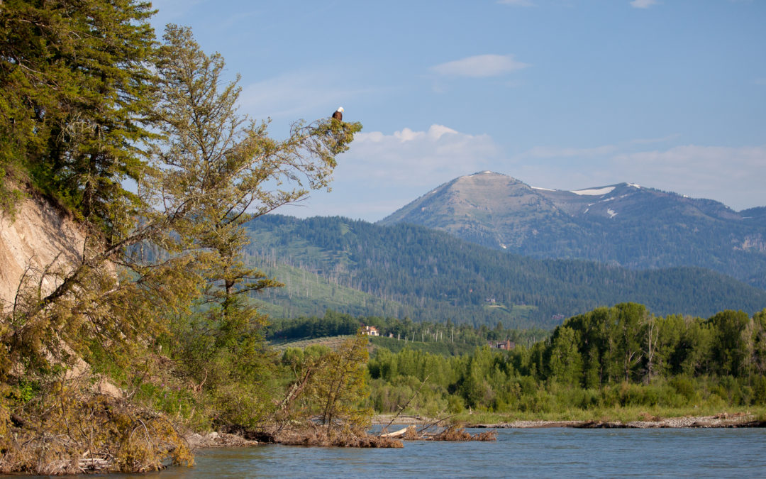
View of the Snake River looking south off the port side bow.
Lead volunteer Tim Griffith generously compiles a full report of our observations at the end of each float season. You can read Tim’s full 2018 report here. You can also check out previous years of data here and let us know if you can identify any wildlife trends on your own!
Our Bald Eagle data is also a great example of how we should be careful when making conclusions from our float data. For instance, each of the last three years our Bald Eagle sightings have peaked in mid-August, which also happens to be when river flow (or discharge) is at .or near its weakest. One might conclude that the low-water means easier fishing and scavenging for the eagles, and that Nature Mappers have discovered that this is the time a birder is mostly likely to encounter an eagle on the Snake River. But perhaps less discharge simply means a slower float, and thus more time for Nature Mappers to sight eagles from the boat?
Flow rate of the river is one of many hidden variables that we should be aware of when we make data comparisons. Everything from shifting river channels to the skill and number of nature mappers on board can influence what we observe. What we can say for sure, is that float data shows presence (not absence) of wildlife species. Our data is still extremely helpful in understanding what creatures are utilizing the Snake River corridor and potential timing of usage, such as when birds are migrating, and if timing of migrations is changing. Thanks to the number of variables at play, Snake River Float Trips are a fascinating study in how complicated getting a full understanding of an ecosystem can be!
If you’d like to sign up for this year’s floats you can contact us at info@jhwildlife.org or Tim Griffith at timgrif396@gmail.com. Trips depart from the Wilson Boat ramp early, Sunday mornings. No prior boating experience is needed.