As wildlife conservation professionals, we remind ourselves to celebrate the successes. Sometimes we get so wrapped into understanding and mitigating the challenges facing wildlife that we feel frustrated. In these moments, it is sometimes in our best interest, our community’s best interest, and the best interest of the ecosystem to also tally up and celebrate the successes we have achieved. By doing so, we rediscover the wind in our sails. By sharing our observations of our successes, we hope to provide inspiration for our colleagues and friends (all of you!) to continue your conservation efforts!
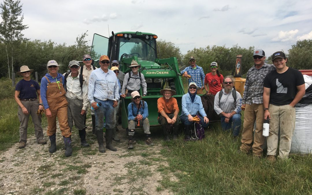
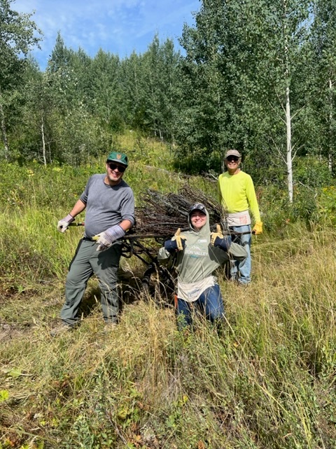
Volunteers after a successful fence pull in Teton Valley. We scheduled 8 public fence project this year, each taking plenty of time and effort to pull off!
We are happy to recognize a list of recent achievements that we and our colleagues have made happen. Did you follow the hard work that the County did to update the Wildlife Feeding Land Development Regulation (LDR) this spring? Did you know that the LDR does not include land in the Town of Jackson? Jackson manages wildlife feeding concerns separately from the County and they have embarked on discussions about their Wildlife Feeding Ordinance.
At a recent Town Council meeting, staff and Council members were unanimously in favor of improving the language in the ordinance to provide better security for bears and other wildlife. Councilman Rooks aptly summed up the sentiment in the meeting, “We are blessed to live in bear country and we need to act like it.” The Town will go through two more iterations of reviewing the ordinance language before they approve tighter restrictions on wildlife feeding, whether intentional or not.
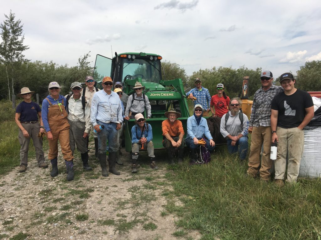
A mule deer uses one of our “levee ramps” to avoid dangerous riprap and access the river.
Do you remember when JHWF installed ‘wildlife ramps’ on the Snake River levee? That project fledged circa 2013 under the leadership of Greg Griffith with help from Gene Linn from the nearby Linn Ranch. The goal was to make it easier for all wildlife, but especially hooved animals, to access the river by giving them a path though riprap (large, uneven rocks) in which an ungulate could easily break a leg. Three ramps were built and trail cameras immediately captured images of elk, moose, deer, and even coyotes drawn to this new, preferred access to the Snake River.
This summer we worked the with Teton Conservation District to install additional wildlife ramps along the levee system near the Wilson Bridge. The additional ramps augmenting the impact of the existing ramps by increasing the number of easy access locations on the many miles of riprap along the levee Our trail cameras are currently in place, collecting images of wildlife using the ramps. We can’t wait to show you what we’ve found!
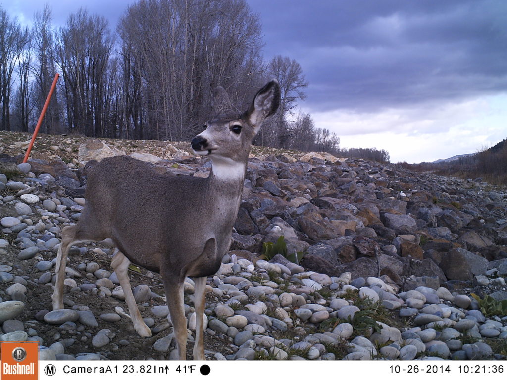
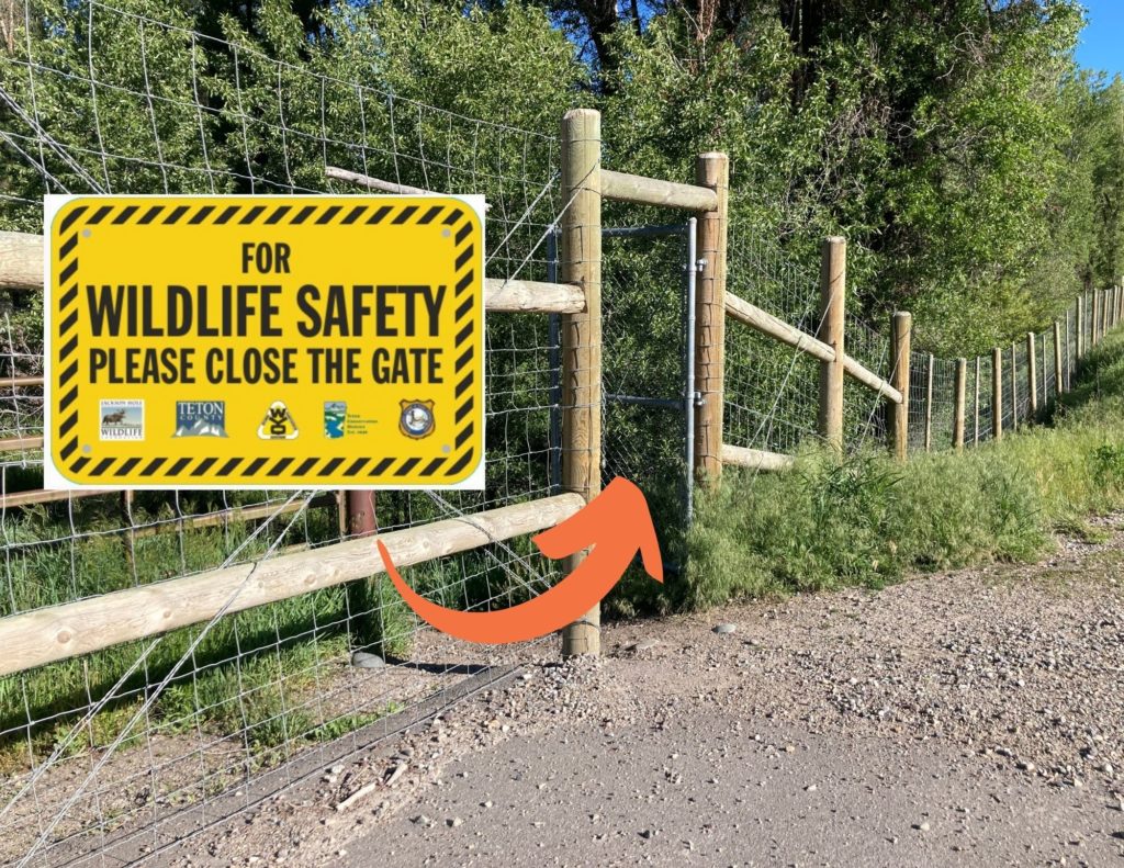
You can help keep wildlife off the highway by keeping the pedestrian gates closed!
Another win for wildlife in our community has been the system of exclusionary fencing and wildlife underpasses on S. Hwy 89, between Melody Ranch and Hoback Junction. Preliminary data has already shown a reduction in wildlife-vehicle collisions (especially involving mule deer) as animals are learning to use the underpasses to move beneath the roadway.
Last month, we worked with our partners at WYDOT, Teton Conservation District, Wyoming Game and Fish and Teton County to design, order, and install signage on the many pedestiran gates along this stretch of roadway. When these gates are accidentally left open, wildlife are able to access the highway instead of being funneled by the fencing to the underpasses. Ensuring the gates stay closed is important in order to allow the fencing and underpass system to do its job moving forward.
Of course, there are staffing successes to report too!
Charlie on the Mosquito Creek fence pull
We can’t say enough about the work ethic and positive attitude of our summer intern Charlie Brandin. Charlie played such an important role supporting our bird-banding team in action this summer. She also eagerly pitched in on several fence pulls and helped us collect data on existing fences in Grand Teton National Park as part of a major fence inventory project we’re undertaking with both the Park and Bridger-Teton National Forest.
While Charlie recently departed to begin her junior year of college on the East Coast, we are now looking forward to filling a new, full-time position of “BearWise Jackson Hole Program Manager.” This position will allow JHWF and our BearWise Jackson Hole partners to better address the persistence of human-bear conflict here in Teton County. Our goal is to have the new Program Manager out in the field helping to reduce conflicts by mid-November!
In recognition of all of this and more, won’t you join us in celebration?
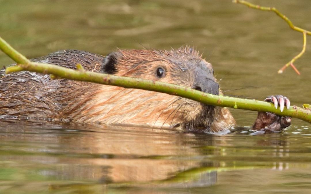
Jackson Hole Wildlife Foundation is excited to announce a new partnership with beaver researcher and hydrologist Jeff Burrell and a new project for interested Nature Mappers – Beaver Project! In Beaver Project, Nature Mappers will provide information about beaver sign they detect on the landscape in the Jackson Hole area. Read on for more information about Beaver Project from Jeff:
It is well documented that beavers provide a wide range of ecosystem services including benefits for water quality, water quantity, and fish and wildlife habitat. Beavers also make ecosystems more resilient to the impacts of climate change. These benefits include reducing peak stream flows, and so limiting erosion and damaging flashfloods; improving drought resilience and increasing ecologically beneficial natural water storage; stabilizing water temperatures; and creating/maintaining fire breaks and refugia from fires.
“More than ever, we need beavers doing what they do so well, but they need our help. Information provided by citizen scientists will help wildlife managers understand where beavers are on the landscape and what services they are providing. In Beaver Project we will gather this information by a simple process of field surveys and observations. Beavers leave behind a record of where they are or were active, and what they are or were doing. So not only can we learn about where they are now but where they were active in past. This will help us understand trends in beaver activities so federal and state agencies as well as private landowners can take actions to help ensure beaver conservation and restoration.”
Beaver Project Protocol:
Email hilary@jhwildlife.org to be added to Beaver Project in your Nature Mapping account. Not a trained Nature Mapper? Email hilary@jhwildlife.org to sign up for the August 24th training.
While out hiking along creeks, check waterways for beaver sign. If you see sign on the landscape, please consider Nature Mapping it.
If you see a live beaver, please use Casual Observations, rather than Beaver Project to document the sighting. Beaver Project is for sign only. If you observed a live beaver and beaver sign, you can indicate the live beaver in the notes section of the Beaver Project form.
Beaver activity indicators are conveniently grouped into the following categories. Because many beaver activity indicator persist through time, we can also group activities into current activities (within the past few months, recent activities (within the past year or two, or past activities (more than two years old).
Please view Jeff’s Beaver Sign Identification Seminar on our YouTube channel for more information.
In Nature Mapping Jackson Hole’s Beaver Project, check the boxes of all activity indicators you observe on the landscape, and their ages.
1. Clipping and girdling:
Beavers are famous for chewing wood to gather food and building materials. As they do so, beavers leave distinctive patterns of tooth marks. ‘Clipping’ means that the beaver directly chewed through the wood; ‘girdling’ means that the beaver partially chewed through the wood and then let wind and gravity do the rest.
Current: the wood has a fresh appearance (fresh wood color with sharp tooth marks)
Recent: the wood has changed to a darker color but still retains sharp markings
Past: the wood is much darker and more weathered in appearance with cracks and feathered markings
2. Food rafts, caches and feeding stations:
Beaver gather and store branches to eat (now or later). These branches will have the characteristic tooth marks of clipping and girdling, and can be grouped into age categories in the same fashion as clipping and girdling.
3. Slides:
Beavers move branches from harvest location to ponds and streams. To do so they pull the material into the water; these activities leave behind a smooth ramp in the mud adjacent to the pond or stream. These ramps are ‘beaver slides.’
Current: the slide is very smooth in appearance with few if any other animal tracks
Recent: the slide is still somewhat smooth but will likely show other animal tracks
Past: hard to distinguish between a beaver slide and animal path, but the location will help identity as a beaver slide
4. Bank dens, bank lodges and free-standing lodges
A bank den is a simple home burrowed into the stream or river bank. A bank lodge is similar to a bank den but has been reinforced by beavers building a dome of branches and mud above the burrow. A free-standing lodge is a pile of branches reinforced with mud within the pond.
Bank den: current (fresh, maintained appearance with current clipping around the entrance, recent (similar but the entrance will show some degradation and only recent clippings, past (very degraded and likely at least partially collapsed.
Bank lodge: see above but now we can use appearance of reinforcing branches and mud to categorize as current, recent and past
Free-standing lodge: current (current clipping and fresh mud piled on top of branches, recent (recent clipping and mud at least partially washed away, past (past clipping and most if not all mud washed away
5. Scent mounds:
Beaver use piles of debris (leaves and twigs) and castoreum (a glandular scent) to mark territories.
Current: fresh leave and twig appearance and scent
Recent: appearance more weathered and little if any scent
Past: likely not identifiable as a scent mound
6. Tracks and scat:
These are the most ephemeral of the indicators we will use. Mainly note if observed
Current: fresh appearance
Recent: degraded appearance
Past: unlikely to be identified
7. Canals:
Beavers excavate canals from the channel or pond to provide safe access to food resources.
Current: sharp boundaries with little vegetation overgrowth
Recent: boundaries less distinct with some vegetation over growth and partial collapse
Past: substantial over growth and collapse
8. Dams:
Since dams are for the most part constructed from branches and mud, use appearance of these
Current: fresh cut branches and mud
Recent: recent branch appearance and mud partially washed away
Past: past branch appearance and mud mostly gone
Thank you for your contributions to this important data set. We look forward to understanding more about beaver distribution in Jackson Hole from our partnership with Jeff!
As Nature Mapping Jackson Hole nears its landmark 1000th certified Nature Mapper, I thought it would be fun to write an article featuring a couple of newer Nature Mappers who were just trained in the last year. Many of you have participated in Nature Mapping and its variety of projects since its inception in 2009, but lots of new Nature Mappers have joined our ranks recently and we warmly welcome them!
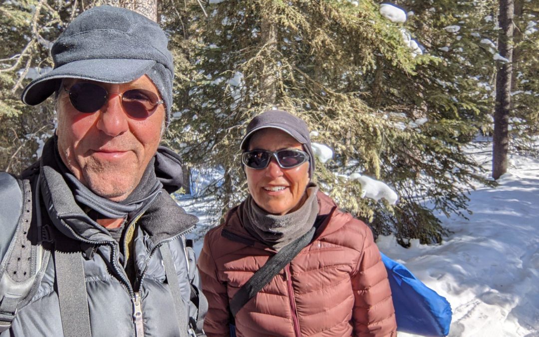
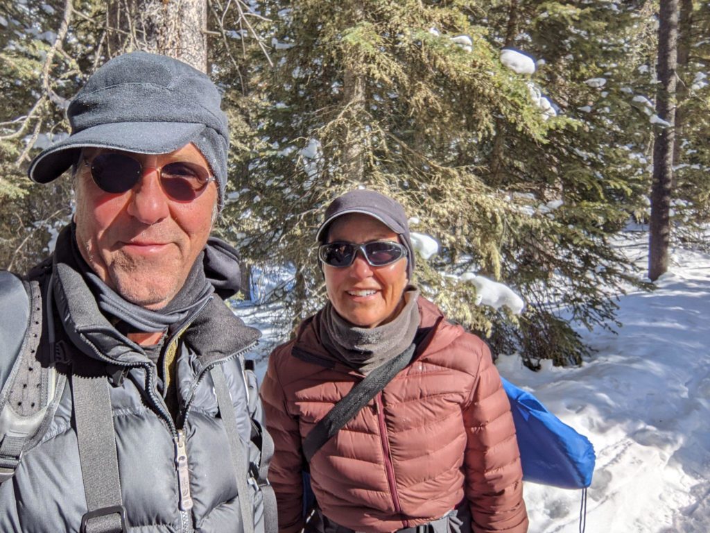
John and Kathy at Moose Day.
Kathy O’Neil and John Norton have been visiting their property in the Teton Valley since 2006 and finally made the area their home in 2020 after Kathy retired from a career as a physician specializing in women’s imaging radiology. John describes himself as “never having been career minded,” but had a variety of interesting experiences throughout his working years. He served in the US Air Force for 10 years, during which time he received an MS in Astronautical Engineering. After leaving the Air Force, he cycled across America, “married his best friend [Kathy],” and moved to Salt Lake City where he worked as a consultant for a variety of organizations.
Kathy loves living in the Teton Valley, a “beautiful community” where she has already become heavily involved in conservation and wildlife projects. She hopes to become even more involved, as she trains to become a certified Idaho Master Naturalist through the Idaho Department of Fish and Game, and continues her education through opportunities with the Jackson Hole Wildlife Foundation. Kathy and John both enjoy skiing, hiking, and viewing wildlife. John describes the GYE as “providing a canvas for doing all the things I love to do.”
The couple tuned into the virtual October 2021 Nature Mapping Certification Training together from their home in Driggs, ID. They heard about JHWF’s Nature Mapping program through the Teton Regional Land Trust, as well as involved friends, and immediately began participating in a variety of Nature Mapping projects. Both have submitted data to Casual Observations and Project Backyard as well as attending JHWF Continuing Education seminars and snowshoeing to count moose during Moose Day.
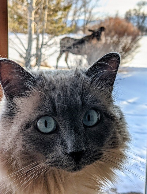
When asked what their favorite animals are, John and Kathy had very different, but equally beautiful answers. Kathy described her ex-feral Siamese cat Smudge, who she rescued. John’s favorite animal is any animal he is near that is undisturbed by his presence. To me, their answers are those of two conservation heroes. Through the action of rescuing a feral cat, Kathy saved not only the life of the cat, but also the lives of the many birds, small mammals, insects, reptiles, and amphibians the cat would have killed over the course of its life as a feral. John’s attempts to view wildlife without disturbing them means he values the safety of the animals on the landscape over his own self-interests such as viewing the animal more closely or getting a great photograph.
Smudge the cat.
All of the Nature Mapping projects they have participated in have been fun for the couple, but they particularly enjoyed Moose Day for the organization and collective effort by citizen scientists. They were also thrilled to participate in Casey McFarland’s tracking class and other continuing education opportunities through JHWF. Together, Kathy and John have submitted more than 100 Nature Mapping observations in a little more than half a year. John’s favorite observation was of a flock of Bohemian Waxwings that he observed this winter in the Teton Valley. He described loving the sounds they made and how the flock “moved through the sky as if it was one organism, an angel.” Kathy’s favorite observation was of a moose that she found sleeping near her bedroom window one morning this winter. She described the experience of realizing they had spent the night only 15 feet apart as one she will not forget.
The couple participate in citizen science because they desire to give back to the wildlife they love. John says, “we share this planet with life forms that modern society has learned to completely ignore, abuse, and destroy.” Through citizen science, he hopes to bring more awareness to these issues. Kathy appreciates that the data she provides will “help policy makers, scientists, and the general public better understand the needs of wildlife.” Both people think that it is important for humans to share the planet with our fellow denizens “in a more respectful way.” Kathy and John are inspired to participate in citizen science because they value personal responsibility and science. Kathy, with her background in medicine, “has a deep respect for science and believes there is an immense potential for deepening our collective knowledge through the contributions of citizen science.” John eloquently states that citizen science “provides a foundation of understanding through thoughtful practices by ordinary people.”
In conclusion, John states, “life is a quilt work of experiences and Nature Mapping is one, recent, piece of the quilt that makes it bigger and warmer.” Through Nature Mapping, Kathy has learned how much there is to see when one pays more attention. When asked what they hope to get out of Nature Mapping into the future, they responded that they hope to share the experiences they have with friends and family, while “contributing to the ongoing health and resilience of wildlife in the GYE.” They each had a bit of advice for other Nature Mappers. John encourages folks to “slow down, watch, and listen,” and Kathy says, “It is valuable work. Stay engaged.”
Nine Years of Data: What are We Starting to Learn?
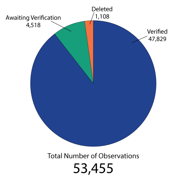
Over the past nine years, 464 people have been trained as certified Nature Mappers and have entered 47,829 observations into the Nature Mapping Jackson Hole program’s central database.
All this effort is filling wildlife observation and distribution needs not already covered by state and federal agencies or local research organizations. Furthermore, together we are fostering a community that looks deeper into the meanings of science and citizenship – therefore, realizing that to participate in the building of knowledge about how our world works, can have profound implications for the way we, Jackson Hole, relate to our natural environment and shape its future.
Thank you for getting involved in the experiences of seeing, feeling, and understanding nature in all its amazingness through Nature Mapping Jackson Hole.
Below is a current snapshot of our database (Note: numbers reflect entries made in the database as of December 7, 2017). In the coming year, JHWF will take a deeper look into the database to better understand data related to volunteer participation and to identify potential increases or declines in any species over time. Stay tuned, there is more to come!
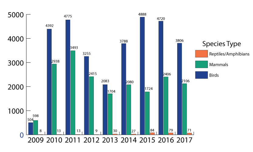
2017 Observations by Project:
Project Backyard – 2,611
Casual Observations – 3,244
Moose Day – 166
2017 Observations by Species:
Reptiles and Amphibians – 71
Birds – 3,806
Mammals – 2,126
Figure 1. Total number of active Nature Mappers by year (2009-2017)
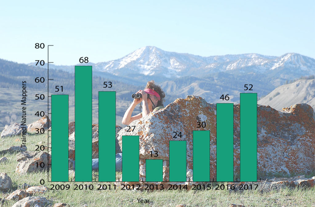
Figure 2. Number of newly trained Nature Mappers by year (2009-2017)
Figure 3. Total number of observations by status in the Nature Mapping Database
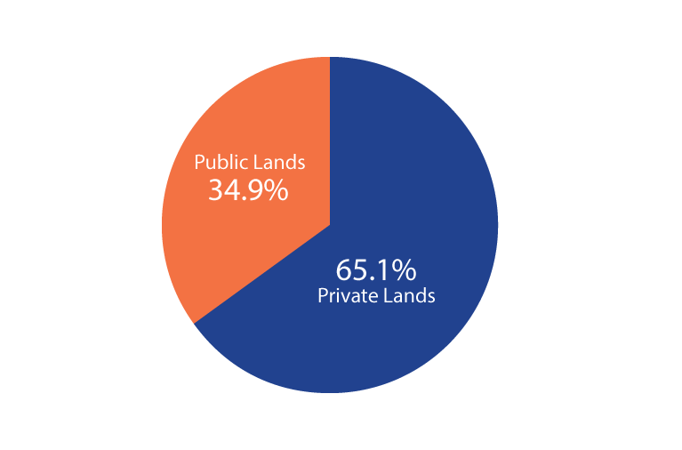
Figure 4. Percentage of Nature Mapping observations that are located on public vs. private lands (verified observations; 2009-2017)
Figure 5. Total number of species entered by Nature Mappers (includes verified, unverified and deleted observations; 2009-2017)
Figure 6. Total number of species by type entered by Nature Mappers (includes verified, unverified and deleted observations; 2009-2017)
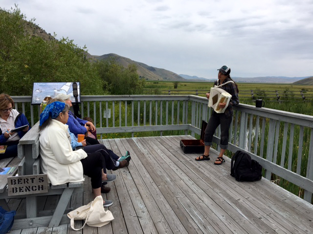
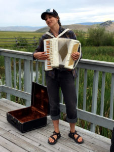
Very recently an exclusive opportunity was made available to all certified Nature Mappers and 13 of them joined JHWF and scientist Anya Tyson on July 25 for a discussion on the Clark’s Nutcracker — a clever bird with a big conservation importance.
As the primary seed disperser of the whitebark pine, Clark’s Nutcrackers plays a critical role in our ecosystem (whitebark pine nuts are a key, high-energy food source for grizzly bears). Severe mountain pine beetle outbreaks and an introduced fungus — white pine blister rust — have caused the whitebark pine to decline across much of the northern Rockies. As forest managers attempt to restore and protect these alpine zones unique to places like Jackson Hole, they need more data on how nutcrackers are using our high-elevation forests, which can be challenging to obtain given the difficulty in sending larger numbers of researchers into the field, especially given the backcountry terrain.
For our private scoop on the latest news, we gathered at Bert’s Bench in the Murie Family Park and over a fresh brew of coffee, enjoyed an update from Anya about her citizen science work with students to conduct habitat surveys in relation to observations of Clark’s Nutcrackers in the backcountry. Anya also gave us an update on Dr. Taza Schaming’s research that uses Nature Mapping data alongside other datasets to model which habitat features best predict Clark’s Nutcracker presence in mountain landscapes. Her recommendations to land managers will help guide whitebark pine conservation and restoration efforts.
Keep a look out for this clever bird and enter your observations into the Nature Mapping Jackson Hole database under Casual Observations. Alternatively, for those active with Project Backyard be sure to notice and record if Clark’s are visiting your feeders later in the year.
Every data point logged for Clark’s Nutcracker will be useful for Anya’s project work and Dr. Taza Schaming’s research.
Anya would love to hear of any interesting stories related to your Clark’s Nutcracker observations and she encourages you to email her at: anyamtyson@gmail.com. Learn more about the Clark’s Nutcracker Project here.


 Very recently an exclusive opportunity was made available to all certified Nature Mappers and 13 of them joined JHWF and scientist Anya Tyson on July 25 for a discussion on the Clark’s Nutcracker — a clever bird with a big conservation importance.