Our collective Nature Mapping observations create a long-term dataset of wildlife distribution throughout Jackson Hole. The obvious benefit is that these data provide a more comprehensive view of how wildlife use the valley. The less obvious product of the database is that it includes data that show us how human presence affects wildlife, often in the form of wildlife mortality. The most common reference source for human-caused wildlife mortality is the Jackson Hole Wildlife Foundation’s Wildlife-Vehicle Collision Database. It contains data derived from WYDOT and Wyoming Game & Fish carcass and crash counts, but also includes Nature Mapping observations from citizens who report roadkill to JHWF at 307-739-0968, or enter their roadkill observations directly via their Nature Mapping account. All of these records eventually are cross-checked to remove duplicates. It is an important resource, adding to our local knowledge, and helping to inform county-wide plans to find solutions that save wildlife and make our highways safer for drivers.
The Wildlife-Vehicle Collision (WVC) Database captured 259 collisions in 2015. Data for the 2015 update was acquired from the following data sources: Wyoming Department of Transportation – Carcass (118), Wyoming Department of Transportation – Crash (70), Wyoming Game and Fish Wildlife Observation System (33) and Nature Mapping Jackson Hole (28). In total, the WVC database contains 46 total species with mule deer, white-tailed deer, elk and moose being the most prominent species involved in WVCs.
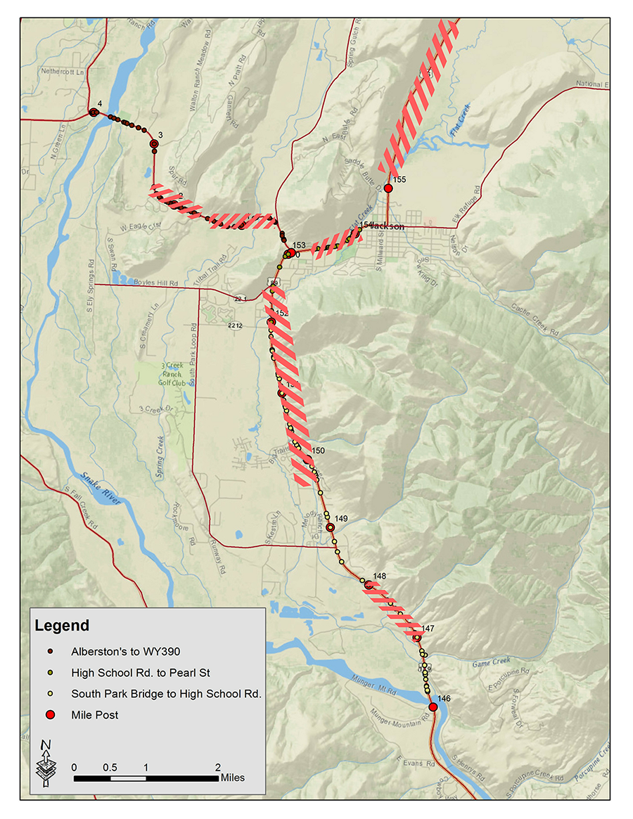
The below map shows where the most frequent collision points are on the local highway network. The highlighted areas had the highest number of collisions from 2013-2015. During this intense winter of 2016-2017, these data have helped us to pinpoint places to add emergency mitigation measures. If you see a dead animal on the side of the highway – small mammals and rodents as well as ungulates – please enter it into the Nature Mapping database, or call us at 307-739-0968 with precise location and time and our staff will enter it. We are likely underestimating the number of animals struck on the highways – certainly for non-ungulates – and our future solutions will depend on our ability to accurately capture what is happening on the roads. Thank you for your help!