by jhwildlife | May 23, 2018 | Blog, Nature Mapping Jackson Hole
by Max Frankenberry, JHWF Assistant Bird Bander
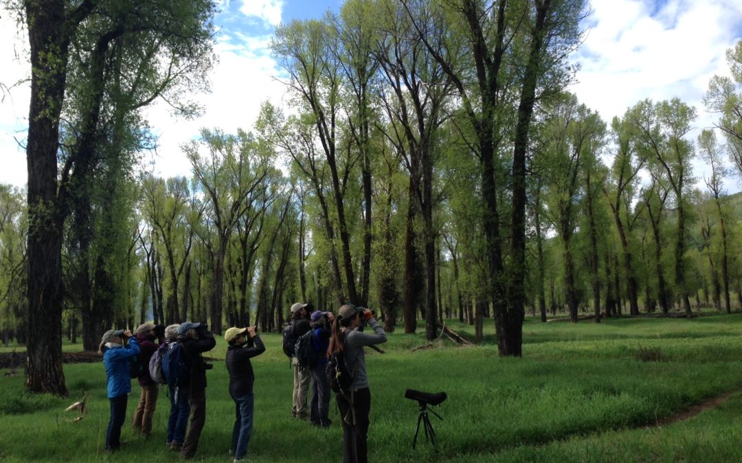
This past Saturday, May 19, 2018, JHWF staff participated in the annual Wyoming Game & Fish Department bird survey of the South Park Wildlife Habitat Management Area, just south of Jackson. Our group of volunteer birders, including enthusiastic Nature Mappers and Jackson Hole Bird & Nature Club members, met bright and early Saturday morning, led by our local bird nerd expert volunteer, Tim Griffith. Tim has been crucial to organizing Game & Fish bird surveys of the South Park area since 2016, which have so far logged 96 different species for the area! Our pack split into two groups, one to tackle waterfowl, shorebirds and raptors around the ponds, the other to take on “Warbler Alley,” the thick cottonwood tree groves hugging the backwaters of the Snake River to the southeast. What an appropriate nickname that was – Yellow Warblers dotted most every tree in South Park, and were joined by the radiant Yellow-rumped, Wilson’s and MacGillivary’s Warblers as well. It was a different traveler from the south, however, that took everyone by surprise.
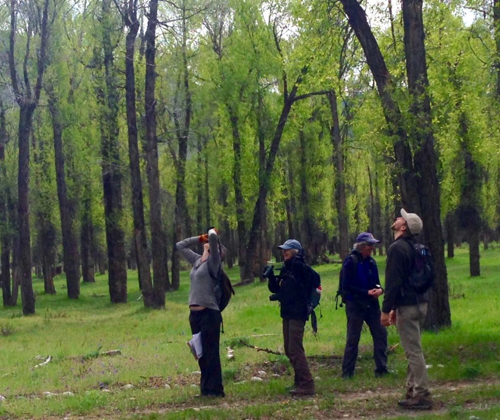
‘Warbler’s neck’ is a common occurrence on a bird survey.
After a busy four hours of hiking and birding the survey was winding down, and brunch was on the brain. But birding tends to deliver the bombshells at the last moments, and Saturday was no different. Jon Mobeck, our team’s oriole-obsessed leader shouted. “Bullock’s! Wait… BALTIMORE!” In a low hawthorn tree not 50 feet from us, was not only a Bullock’s Oriole, a gorgeous but fairly common bird in Jackson Hole, but next to it was a Baltimore Oriole, a normally much more eastern cousin. Historical records vary, but this bird may be one of less than a dozen ever reported in the state of Wyoming, and likely less than a handful have ever been seen in Teton County. What a find! The Bullock’s and Baltimore seemed to follow each other, flying from tree to tree after one another. Perhaps the Baltimore had lost his way on his normal spring route up from Central America, noticed a bird that resembled his brilliant orange color, and followed that Bullock’s back to our western mountains, far away from his normal east-of-the-plains summer vacation.
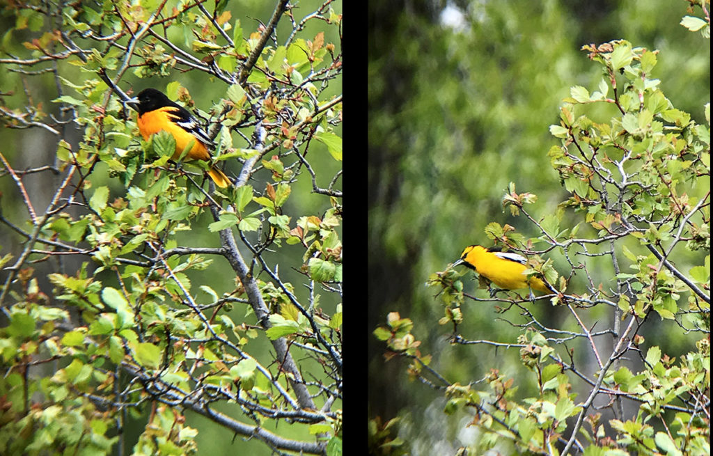
A Baltimore Oriole (left) is a rare find in Jackson Hole. The Bullock’s Oriole (right) is more of a local. Photos: Kate Maley
It’s moments like these that make us realize how special close-to-home wild places like South Park are. The diversity of wildlife in these areas can be astounding. But problems exist in the fact that unless these places are studied or surveyed, we may never know the rarities or struggling populations there. This is the issue Nature Mapping Jackson Hole is helping to solve – by submitting data from your commute from work, a dog-walk in a Jackson city park or a backpacking trip through the Gros Ventre, you are helping to build our human community’s understanding of the wildlife community that surrounds us. And every data point really is significant! You don’t often find rare birds like the Baltimore Oriole, but it’s very possible that the deer you saw driving home could represent the beginning of a muley movement exploring a new feeding ground in Jackson Hole. The data you enter from these sightings help JHWF’s partners to prepare management decisions that inspire positive interaction between humans and the wildlife moving into these areas. Knowing that your effort can directly benefit our local species is a reward in itself, and who knows – maybe your attention to wildlife developed from Nature Mapping will lead you to that once-in-a-lifetime animal.
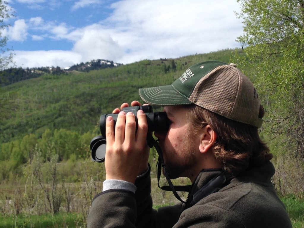
Max Frankenberry spots a Common Merganser on a back channel of the Snake River through Wingspan Optics binoculars.
South Park Wildlife Habitat Management Area Species Count 2018 Surveyed by 22 Participants
American Coot 3
American Crow 1
American Goldfinch 11
American Kestrel 13
American Robin 74
American White Pelican 38
American Wigeon 9
Bald Eagle 6
BALTIMORE ORIOLE 1
Bank Swallow 4
Barn Swallow 6
Barrow’s Goldeneye 16
Belted Kingfisher 4
Black-billed Magpie 9
Black-capped Chickadee 24
Black-headed Grosbeak 2
Blue-winged Teal
Brewer’s Blackbird 1
Broad-tail Hummingbird 2
Brown-headed Cowbird 6
Bufflehead
Bullock’s Oriole 4
Calliope Hummingbird 6
Canada Goose 114
Cedar Waxwing
Chipping Sparrow 2
Cinnamon Teal 47
Cliff Swallow 7
Common Merganser 37
Common Raven 15
Common Yellowthroat
Cooper’s Hawk 1
Dark-eyed Junco
Double-crested Cormorant
Dusky Flycatcher
Eared Grebe
Eastern Kingbird
European Starling 21
Gadwall 84
Gray Catbird 1
Great Blue Heron 6
Green-tailed Towhee 1
Green-winged Teal 2
House Wren 14
Killdeer 12
Lazuli Bunting
Lesser Scaup 7
Lincoln Sparrow
MacGillivary’s Warbler 3
Mallard 52
Marsh Wren 5
Mountain Bluebird
Mountain Chickadee
Mourning Dove
N. Rough Wing Swallow 11
Northern Flicker 19
Northern Shoveler
Orange-crowned Warbler 2
Osprey 6
Pied-billed Grebe
Pine Siskin
Redhead Duck
Red-naped Sapsucker
Red-tailed Hawk 6
Red-winged Blackbird 62
Ring-billed Gull 2
Ring-necked Duck 12
Ruby-crowned Kinglet 7
Ruddy Duck 4
Sandhill Crane 3
Savannah Sparrow 6
Sharp-shinned Hawk
Song Sparrow 51
Sora 3
Spotted Sandpiper 24
Swainson’s Thrush 1
Tree Swallow 219
Trumpeter Swan 2
Turkey Vulture 6
Vesper Sparrow 2
Violet-green Swallow 3
Virginia Rail 1
Western Meadowlark 3
Western Tanager 1
Western Wood Pewee
Western/Clark’s Grebe
White-breasted Nuthatch 1
White-crowned Sparrow 3
White-faced Ibis
Wilson’s Phalarope
Wilson’s Snipe
Wilson’s Warbler 1
Wood Duck
Yellow Warbler 130
Yellow-headed Blackbird 37
Yellow-rumped Warbler 94
Species Total 68
by jhwildlife | May 17, 2018 | Blog
by Jon Mobeck, Executive Director
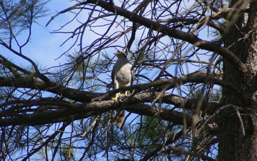
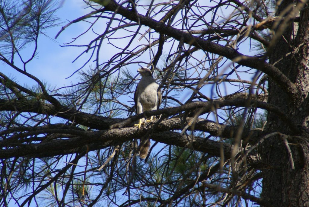
This is the story of an elusive and magnificent bird, and a story of a walk in the woods. They are connected.
I enjoy wandering in the forest, looking and listening for things. I’m not alone.
One morning recently, I parked at the trailhead, pulled out my phone and tapped the Audubon Birds Pro app. Before I entered this particular mixed forest of aspen and conifer, I wanted to familiarize myself once more with the calls of the bird I hoped to find.
Northern Goshawk (Accipiter gentilis). Family: Hawks and Eagles. Description: 20-26” (51-66 cm). W. 3’ 6” (1.1 m). Adult distinctive if seen well, gray-barred below, with black face, sharp white eyebrow. Voice: Loud kak-kak-kak-kak-kak when disturbed.
One more time. Kak-kak-kak-kak-kak. Listen. OK. Got it.
As I start walking, I don’t want to play the sound anymore since it can be disruptive to birds – and to me, since I want to be present here. But I do replay the goshawk call in my head. That is, until the calls and songs of other birds capture my attention. First I hear an American Robin, and then many, zipping from one aspen branch to the next. A bit farther up the trail I see a Ruffed Grouse strut across the path. Curious how uninterested they seem to be in my presence. Surrounding me are the songs of the Black-capped Chickadee, reminding me of my childhood in the woods of Minnesota. Hearing the song of a chickadee connects time and space for many of us.
Back to the Northern Goshawk. (My mind wanders with the birds!) I leave the trail and start heading uphill into a deep stand of pine. Within a few minutes, I hear it. No mistaking it. I’m going in the right direction! Based on where I think I heard the sound, I’m probably a few hundred yards away. Just over some deadfall and up the hill somewhere. I scramble up with excitement. The Northern Goshawk is not the sort of bird that you run into every day. You have to make an effort to find it. And I’m close!
Walk. Wait. Walk. Wait. Walk. Wait.
Where is that bird?
I sit on the trunk of a fallen tree. I watch. I listen.
I hear many Ruby-crowned Kinglets and Dark-eyed Juncos, but no goshawk.
Two hours pass and I never hear the Northern Goshawk again. I never see it.
I walk back to the car, but I’m not defeated. This is what makes the Northern Goshawk great. I will concede victory on this day to the bird. This is what makes so much of our wild world wonderful. There are a billion things happening every second. We are aware of so little. But we can watch. We can listen. We can learn.
There’s a saying that conservationists often point to as truth, something to the effect that one has to see something to know it, and then they might grow to love it, and only then will they act to protect it.
I understand that perspective, and it probably does make conservation in a general sense easier, but I think it’s more interesting to consider an ethic that acts to protect the things we don’t know.
If we think we are only capable of protecting the things we love through personal experience, the Northern Goshawk stands little chance. A very small percentage of the people on Earth will have a personal experience with a goshawk. We surely won’t be able to have personal experiences with all of the things that we need to protect on Earth.
The State of Wildlife in Jackson Hole, commissioned by the Jackson Hole Conservation Alliance, identified the Northern Goshawk (and the mature forest within which it thrives) as a key indicator of the health of our ecosystem. A brilliant choice, but not just ecologically.
“Wilderness itself is the basis of all our civilization,” legendary conservationist Mardy Murie once said. “I wonder if we have enough reverence for life to concede to wilderness the right to live on.”
Our reverence for wilderness will determine the fate of the Northern Goshawk. Is it important to protect vast stretches of uninterrupted forest? Yes! The Northern Goshawk needs it and so do we, for it’s in those stretches of woods, among the calls and songs of countless birds (and squirrels and a thousand other things), that our spirit, our imagination, and our potential as a species soars. Likewise, the wild places we may never go and the species we may never see require the best of our nature. Might we act to protect things that we do not know? We must and we will. And the experience of this life will be rich!
by jhwildlife | May 16, 2018 | Blog, Nature Mapping Jackson Hole
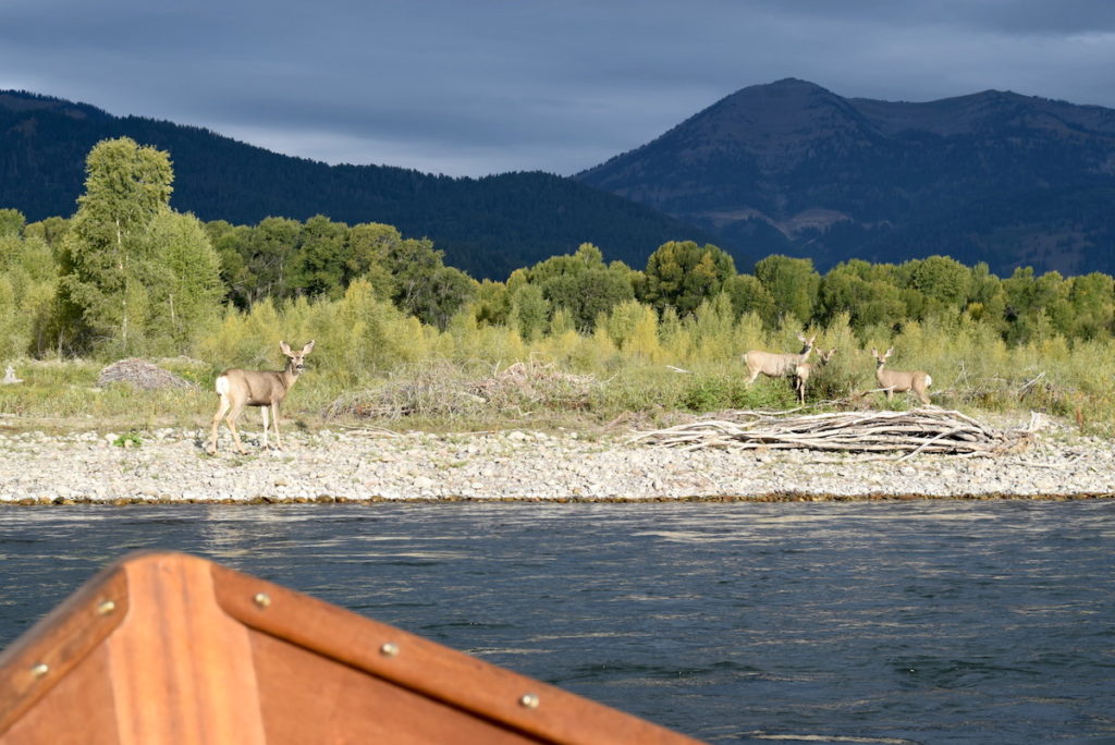
Three mule deer does and a fawn spotted on the Sept. 10, 2017 float trip. Photo credit: Forest Dramis.
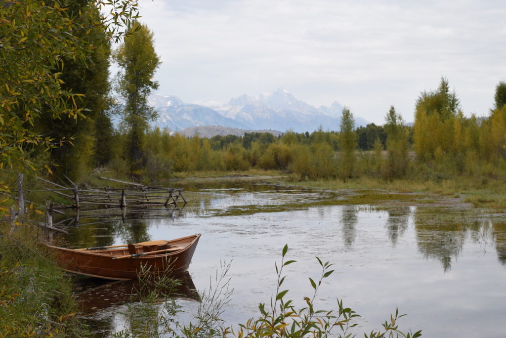
A quick step into the dory and a careful shifting of weight with binoculars raised and off we go, five lucky Nature Mappers floating the Snake River on a sparkling Sunday morning. We glide swiftly and smoothly under the Wilson Bridge (with the chittering of swallows and clamor of traffic overhead) and emerge, calling out: “Two, no three Ravens!” “16 Tree Swallows, I think? They move fast.” “Look, a Great Blue Heron!” “No, Osprey!” “Both!”
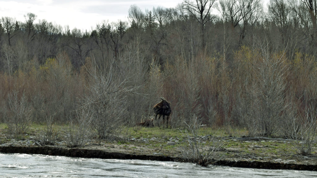
As we flow downstream, we scan the shorelines, water and sky, and settle into intervals of excitement and tranquility. A designated Nature Mapper jots down the tally for common species and takes GPS points for unusual sightings. A morning’s count can include eight Bald Eagles, a moose, numerous Spotted Sandpipers, Common Mergansers, Yellow Warblers, nesting Bank Swallows and a flotilla of American White Pelicans. Or perhaps we spy a marmot family basking on a rock, or a beaver up a backwater.
For seven years, Nature Mappers have been gathering data on wildlife thanks to A.J. DeRosa, owner of Jackson Hole Vintage Adventures. A.J. donates his handcrafted wooden dory and an expert boatman every Sunday morning from May to October. With this opportunity for consistent data collection, Nature Mappers have been able to record trends and shifts in species’ numbers and locations over the summer months (May-October), year to year. We are beginning to discern patterns in species’ migrations, nesting locations, and possibly, with time, impacts of flooding, dike vegetation management and river use.
These results are possible thanks to over four-dozen trained nature mappers and friends participating each year. Ace volunteer Tim Griffith schedules the teams and often adds his expertise on the floats. Since Tim started coordinating the trips with A.J., many species’ sightings have increased significantly. Tim has a fine ear and eye for the birds! Please read Tim’s 2017 Nature Mapping Jackson Hole Snake River Float Trip Annual Report here. It includes a species list and numbers; the special conditions of 2017 during the spring flood and its effect; and the season’s variation in eagle numbers. Be sure to contact Tim if you wish to volunteer on a Snake River Float Trip this summer!
An idyllic setting, Jackson Hole Vintage Adventures Tipi Camp is a wildlife rich habitat Photo credit: Forest Dramis
by jhwildlife | May 14, 2018 | Blog, Wildlife Friendlier Landscapes
by Jon Mobeck, Executive Director
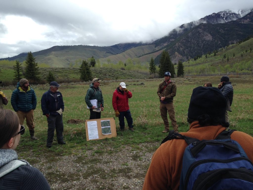
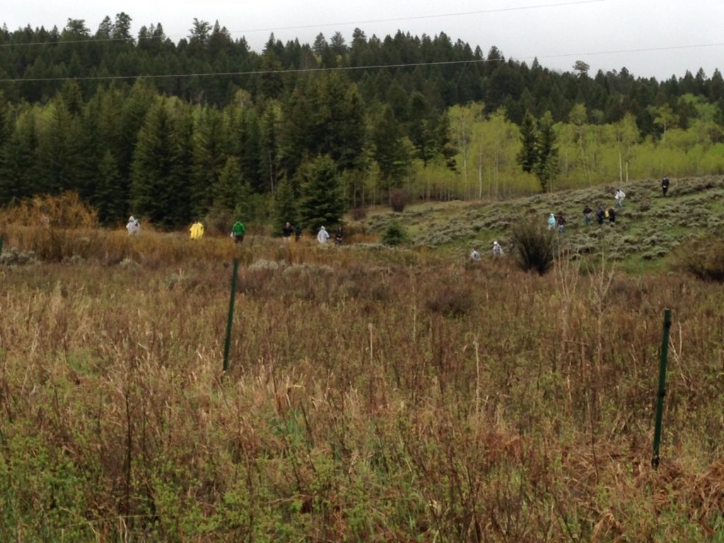
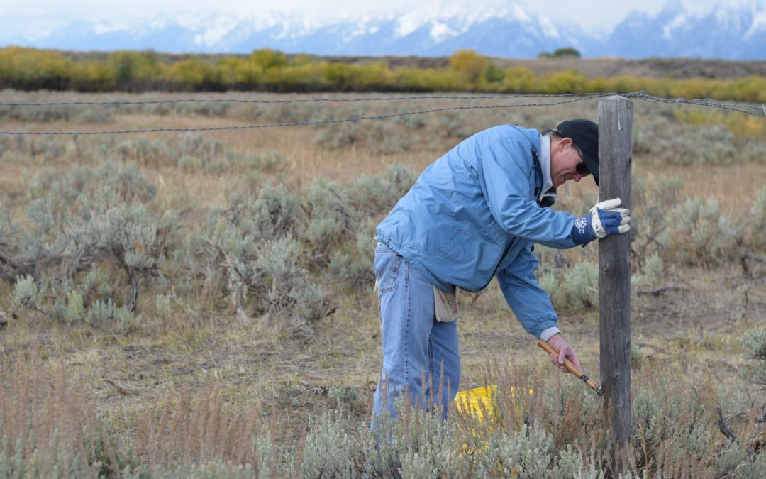
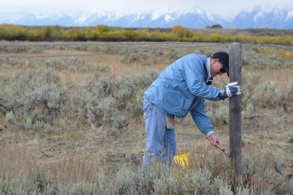
A steady rain saturated the ground as I looked out the window. It was 5:30 a.m. on the day of a fence pull – Saturday, May 12. It’s hard not to feel that a bit more sleep would be a better choice than pulling down barbed wire fences, but that fleeting thought is dismissed as I think about the others who are doing – and maybe thinking – the same thing. I’ve done this work in the rain before, but nowhere near as many times as those key “Fence Team” volunteers who I would join later that morning. And then I have the thought of all the people who have done this over the past two decades, in all sorts of weather conditions, in any terrain. There was never really a doubt that we would pull down fence that day.
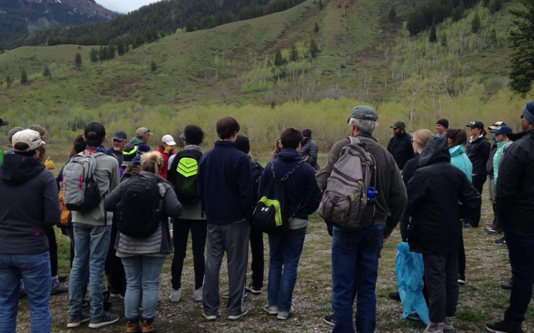
On this day, we were scheduled to benefit from a large volunteer crew generously offered by EcoTour Adventures. EcoTour was hosting a group of 16 students from a school in Louisiana along with an equal number of parents. While visiting (vacationing) here, the Louisianans would see the typically amazing sites of Jackson Hole, experience exhilarating adventures, and learn about the area’s wildlife and natural gifts from EcoTour’s exceptional guides. Because of EcoTour’s commitment to the area’s wildlife, they encourage their guests to participate in activities that help preserve what makes this place special.
On this day, though, with rain coming down and more rain forecast throughout the day, I had assumed that the group would cancel, and I wouldn’t have blamed them for a second. After all, they were on vacation. Pulling down barbed wire fences in the rain is not high on the “to-do” list for most of the vacationing public.
So at 7:22 a.m., when EcoTours CEO Taylor Phillips texted: “OK we are all in for the fence pull. Expected arrival 9:15. Yahoo!” I was surprised. I knew I would be meeting our indefatigable Fence Team volunteer leaders Gretchen, Steve and Randy since we had all decided that we were going no matter the weather, but now the prospect of our small team working through the rain turned into the excitement of a huge group (41) of us doing so together.
As it turned out, the rain was relatively light throughout most of the project, and I was amazed by the resilience of the Louisianans. I suppose they are accustomed to rain, but as one of the parents – James – said, “We don’t get to do anything like this in Louisiana.” The Louisianans worked for 3 hours with us, and it sure seemed like they were having a good time. That knowledge filled me with joy. Here all of us were, in the rain, removing barbed wire fences to make things easier for wildlife. And it was fun! And it reminded me of how great it is to share such an experience with new people, from a different place. We’re all so similar, and we all can do so much together!
Of course, we do this for the wildlife. On this occasion, we worked in an area at the northernmost end of the recently mapped Red Desert-to-Hoback Mule Deer Migration Route. The Wyoming Migration Initiative elucidated this 150-mile route through extensive GPS collaring and subsequent mapping that is now recognized and discussed around the world. Each spring, mule deer that were once thought to be a resident population of the Red Desert region migrate across and through many roads, houses, industrial developments, and about 100 fences before finding summer range in the greater Hoback area. We worked near those summer ranges, where they will spend considerable time, removing obstacles that can separate fawns from does, and just generally make their route more challenging.
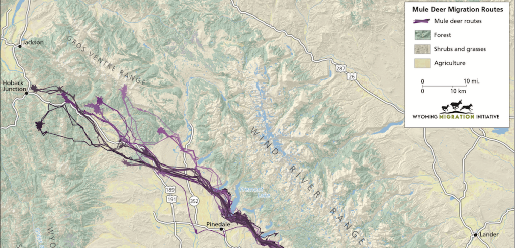
The northern end of the Red Desert to Hoback Mule Deer Migration Route, as identified by Wyoming Migration Initiative, which includes summer range for mule deer.
We were on Bridger-Teton National Forest Land, where we removed about ½ mile of nasty barbed wire fences. It is a privilege to be able to support our agency partners who couldn’t possible deploy enough staff members to remove or maintain every fence in the region. Our volunteer fence pullers pitch in to care for our public lands in partnership with those terrific land managers.
Hundreds of individuals have helped in this way over the past two decades. Some of whom have been on hundreds of fence projects. I’m personally grateful to all of them, and when I pull my boots on to go work on fences, I know that I’m part of something much bigger than me, in so many ways. It is a big, impressive landscape. It is an amazingly long mule deer migration. There are so many people over many years. There is still so much to do.
Thank you to those great young people from Louisiana and their parents, and to EcoTour Adventures. We’re all a part of a great tradition of giving back to the land!
by jhwildlife | May 9, 2018 | Blog, Nature Mapping Jackson Hole
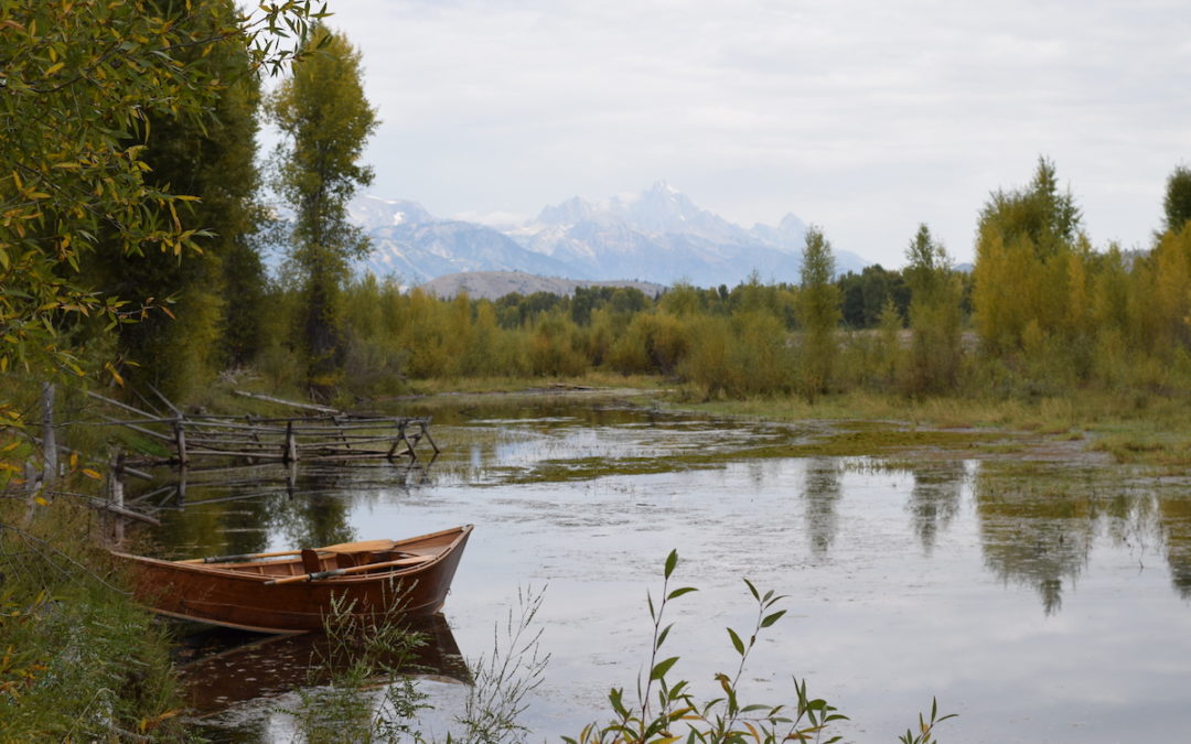
“You can’t be unhappy in the middle of a big, beautiful river.” – Jim Harrison
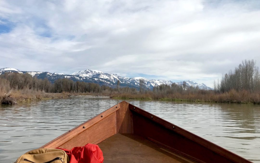
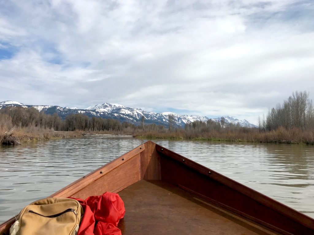
On Sunday, May 6, I had the privilege of participating in my first Nature Mapping Snake River float trip. And what a trip it was!
Along with fellow “bird nerds” Jon Mobeck and Tim Griffith (trip leader/coordinator) and guide Adam “Dutch” Gottschling, I spent two hours of the morning floating the eight-mile stretch of the Snake River between the Wilson bridge and Jackson Hole Vintage Adventure’s Tipi Camp.
Having recently moved to Jackson from the relatively flat plains and forests of the upper Midwest, I have a long way to go before I look up at the grandeur of the Tetons with anything but complete and utter awe. So, had we merely floated for two hours looking only at the river and surrounding mountains, without seeing any wildlife, I personally would have considered my Sunday morning well spent.
That said, we ended up observing over 40 species of birds, mammals and amphibians along the river and in the area immediately surrounding the Tipi Camp. Not bad for the first week of May! (Indeed, I’ve since learned that this is on the high end compared to historic species counts.)
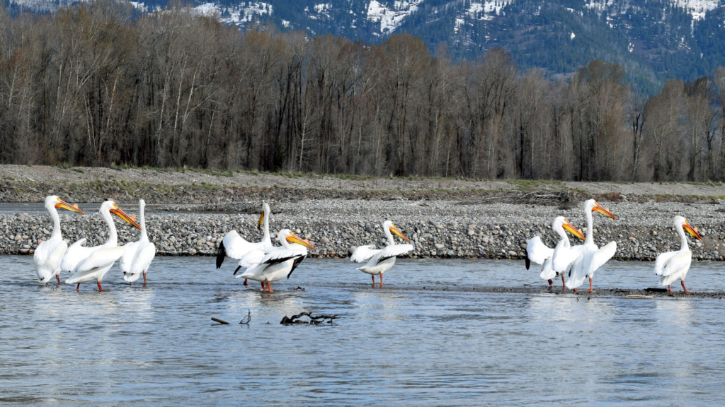
Highlights included 54 American White Pelicans (the largest number ever recorded on one trip), one Swainson’s Hawk, one Merlin, a Greater Yellowlegs and two moose. Though, based on the excitement in the boat, to call the Merlin and Greater Yellowlegs mere highlights is a gross understatement. For good reason too! It turns out only a handful of each species have been spotted by volunteer citizen scientists since the trips began in 2010.
I’d like to say it was beginner’s luck, but I’ve spent enough time appreciating the wild spectacle that is nature to know that to try to claim any credit is silly at best. Besides, who knows what will be seen throughout the rest of this summer? Either way, this trip was an awesome start to what is sure to be an amazing float trip season. Even without such a notable species list, I feel lucky to have been a part of such an experience—to have spent the morning exploring an area of nature that few have the chance to see in a way that even fewer are able to see it.
JHWF partners with AJ DeRosa’s Jackson Hole Vintage Adventures to provide this incredible opportunity to float down the eight-mile stretch of the Snake River between Wilson Bridge and South Park and to collect important data about the various species of mammals, birds and amphibians that use it. Trips take place every Sunday morning from May 6, 2018 through the end of September. Cost is $30 per participant. To learn more, visit the Snake River Float Trip webpage or call the office at 307-739-0968. To sign up for an upcoming trip, contact project coordinator and expert birder Tim Griffith at timgrif396@gmail.com.
Species Counts Along the Snake River
May 6, 2018 8:00 AM – 10:00 AM
Canada Goose 144
Mallard 56
Barrow’s Goldeneye 1
Common Merganser 24
American White Pelican 54
Great Blue Heron 3
Turkey Vulture 4
Osprey 1
Bald Eagle 6
Swainson’s Hawk 1
Red-tailed Hawk 1
Killdeer 3
Spotted Sandpiper 10
Greater Yellowlegs 1
Belted Kingfisher 4
Northern Flicker 4
Merlin 1
Black-billed Magpie 6
American Crow 14
Common Raven 3
Tree Swallow 50
Bank Swallow 5
Cliff Swallow 2
Black-capped Chickadee 7
Ruby-crowned Kinglet 11
Mountain Bluebird 7
American Robin 31
Yellow Warbler 1
Yellow-rumped Warbler (Audubon’s) 5
White-crowned Sparrow 2
Song Sparrow 47
Red-winged Blackbird 11
Brown-headed Cowbird 2
Brewer’s Blackbird 7
Moose 2
Marmot 2
Species Counts at Jackson Hole Vintage Adventure’s Tipi Camp
May 6, 2018 10:15 AM – 10:45 AM
Canada Goose 3
Mallard 3
Green-winged Teal 2
Common Merganser 2
Ruffed Grouse 1
American White Pelican 4
Osprey 2
Killdeer 1
Spotted Sandpiper 3
Downy Woodpecker 1
Common Raven 1
Tree Swallow 1
Black-capped Chickadee 6
Ruby-crowned Kinglet 5
American Robin 5
Yellow Warbler 1
Yellow-rumped Warbler (Audubon’s) 5
Dark-eyed Junco 1
White-crowned Sparrow 1
Song Sparrow 4
Red-winged Blackbird 1
Brewer’s Blackbird 2
Chipmunk 1
Frogs ? (unable to get an exact count)
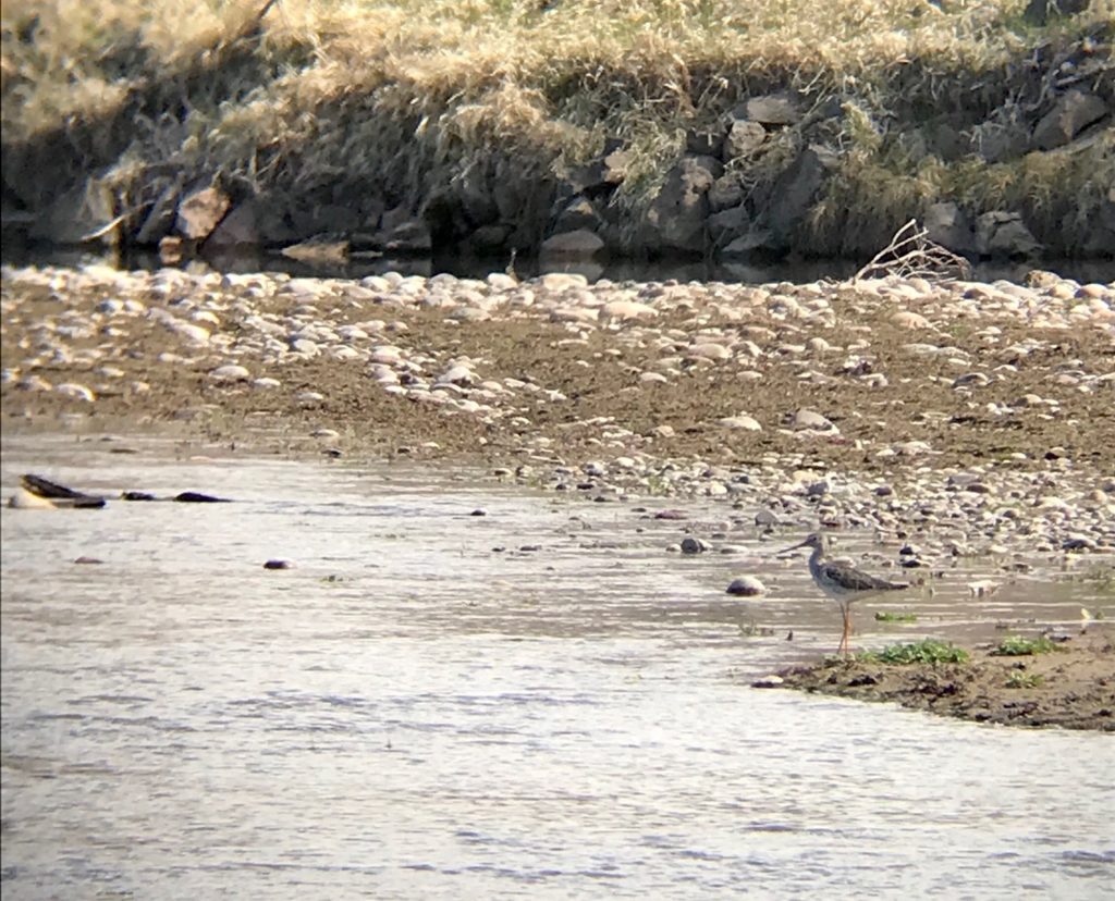
Greater Yellowlegs!!
by jhwildlife | May 4, 2018 | Blog
We are excited to welcome Bruce Pasfield to the Jackson Hole Wildlife Foundation’s (JHWF) Board of Directors executive committee as vice president and Ben Wise as a new board member.
Bruce Pasfield is an attorney who practices environmental law in Wyoming and Washington D.C. He is currently a partner in the law firm of Alston and Bird and has served on the JHWF board since October 2016. Residents of Jackson Hole since 2010, Bruce and his wife Nancy are certified Nature Mappers and frequently volunteer on fence projects. Bruce brings enthusiasm and natural curiosity about wildlife, as well as his legal skills, to his position on the executive committee. Bruce enjoys spending time with his wife and two grown children, mostly in the outdoors birding, cycling, climbing, hiking and skiing.
Bruce Pasfield helps on a fence project last fall on Public Lands Day.
A Worland, Wyo. native, Ben Wise has worked as the Brucellosis-Feedground-Habitat Biologist for the Wyoming Game & Fish Department in the Jackson Region since 2013. Ben is a key volunteer and strategist for the Wildlife Friendlier Fencing program. He also volunteers his time on the Scientific Advisory Committee (SAC) for Nature Mapping Jackson Hole, vetting observations and advising JHWF on scientific goals for the array of projects. In his free time, Ben enjoys traveling, hunting, fishing and exploring all that Wyoming has to offer.
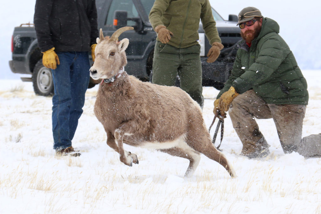
Ben Wise releases a bighorn sheep during a collaborative research project.
The JHWF Board of Directors is comprised of a diverse group of individuals with varied backgrounds including wildlife biology, wildlife management, public relations, law, conservation, planning and development, private business and local government.
The board represents a good cross-section of the community and enables us to have thoughtful debate about current issues and seize opportunities to advance meaningful on-the-ground work. Many board members contribute extensively as volunteers to increase our impact in our core program areas, extending a hands-on legacy that dates back to the origin of the organization in 1993.