Since 2020, the owners of this land have been engaged with local government and community groups regarding the development of their private property in Northern South Park (NSP). The landowners’ intent is to subdivide and develop a 200+ acre section south of Jackson. An option currently being considered would develop the area densely to accommodate as many as 1,800 housing units (the majority of which would be deed-restricted). Alternatively, the landowners could decide to split the land into 35 acre lots. While exactly how the development plays out is still a bit complicated, what can be expected is the future landscape of NSP is likely to resemble something much different than it does in its current layout of cattle pastures and cottonwood-lined irrigation ditches.
A schematic from the 2022 Neighborhood Plan shows a version of how “passive open space” (light green) might be configured to allow wildlife to move through the development.
How might future development impact wildlife?
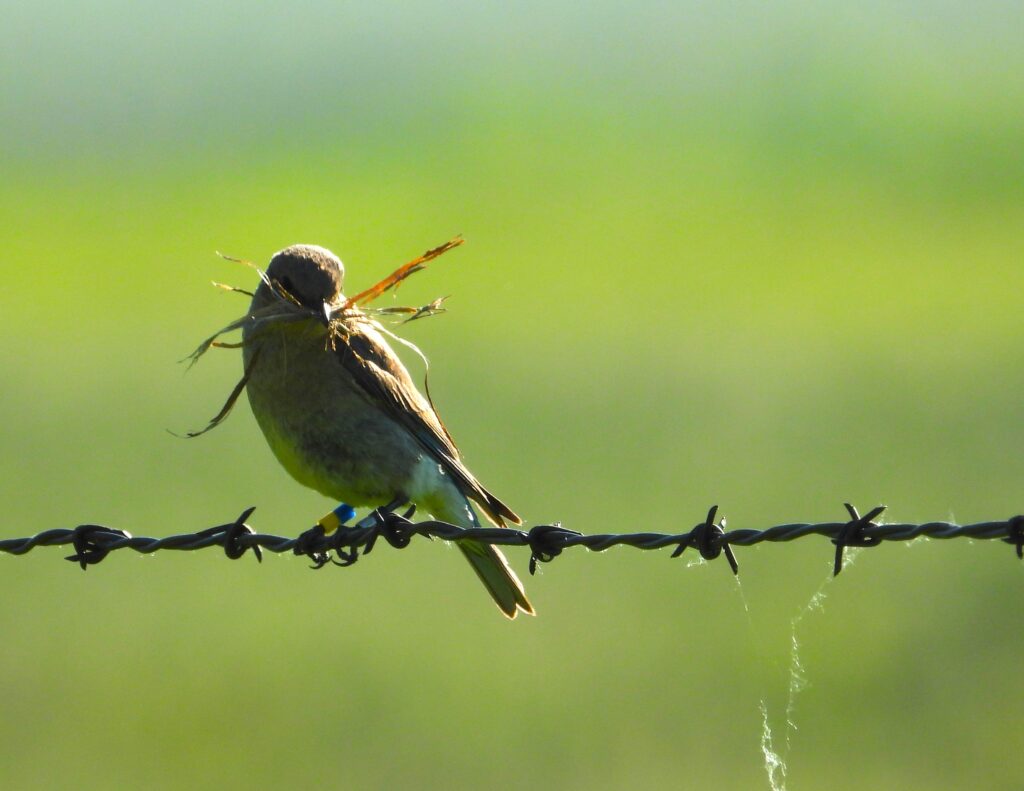
Even in scenarios of highest density housing development we anticipate wildlife will use NSP in similar ways to nearby neighborhoods. Although open space will certainly be lost, as agricultural fences come down (including a current 6′ woven and barbed-wire fence which parallels High School Road from the high school to South Park Loop Road) deer and moose will have easier access to the NSP property. New landscaping may increase attractants and potential phasing-out of elk feedgrounds and the termination of elk hazing in NSP may also encourage new movement patterns through the area. Then there’s Flat Creek on the eastern boundary of the proposed development area. Even within the Town of Jackson, Flat Creek serves as an important movement corridor and habitat for everything from beavers, fish and songbirds, to ungulates and other large mammals. Mule deer wintering on the butte across Highway 89 often access this section of Flat Creek for food, water and cover and we expect they will continue to use the creek, even after the buildout of NSP.
So can Northern South Park be developed in a way that reduces the impact on wildlife?
We believe the answer is yes! Currently, Teton County Planning staff are drafting site-specific Land Development Regulations (LDR) and a new zoning overlay in anticipation of NSP buildout. We joined many of our partner organizations in submitting letters to the Planning Commission. While you can read our full letter here, it essentially covers three main recommendations: 1) the application of wildlife-friendly fencing standards, 2) defined Flat Creek setbacks, and 3) protect open space within the developed area to accommodate wildlife movement.
Wildlife-Friendly Fencing Standards: We encouraged the alignment of wildlife-friendly fencing standards in NSP with the current Teton County LDRs to avoid confusion. We also suggested that open spaces and parks remain clear of fencing so as not to entrap wildlife that happens to wander in.
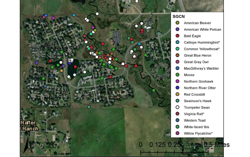
Since 2021, 18 Wyoming Species of Greatest Conservation Need have been reported by JHWF’s Nature Mappers in the Rafter J neighborhood. These data show that the HOA-owned parts of the Flat Creek corridor, as well as the habitat mitigation area, are important for these species. Ideally, NSP would be developed in a similarly responsible way, which would allow for the continued use of the creek corridor by wildlife.
Flat Creek Setbacks: We advised that development not occur within at least 150′ of Flat Creek. A good example of responsible development near Flat Creek is the Rafter J neighborhood. Rafter J’s Flat Creek setbacks, often hundreds of feet in width, are owned and maintained by the Rafter J homeowner association and this protected area supports breeding populations of Wyoming Species of Greatest Conservation Need (WY SGCN) such as Willow Flycatcher and Calliope Hummingbird, along with a large suite of other riparian-associated species. Rafter J also has a habitat mitigation area which supports an impressive community of wetland birds. If NSP can be designed in a similar way, water quality would benefit, as would flood mitigation. This would also help preserve a north to south movement corridor through some of NSPs most valuable habitat.
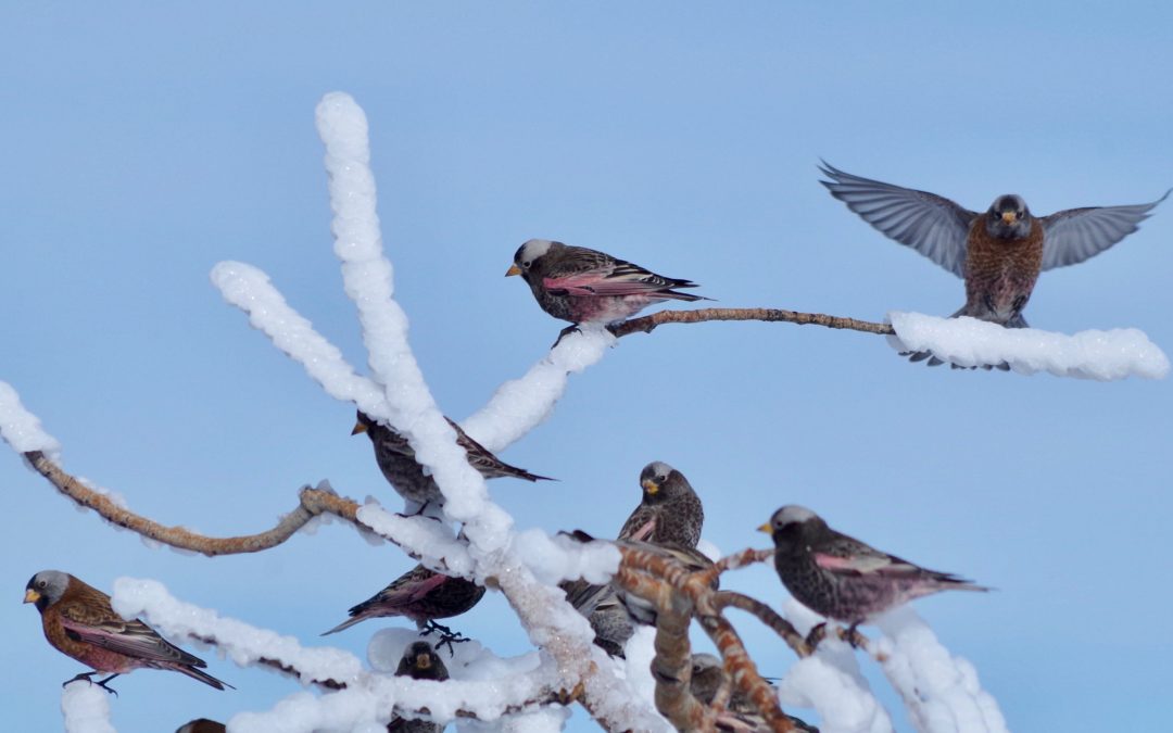
Open Space: Our recommendation is that NSP design accommodate for wildlife movement through and out of the neighborhood though the preservation of linked, “passive” open space. The NSP Neighborhood Plan, released in 2022, contains sketches of how this open space might be connected and used to allow wildlife passage through the developed area. Ideally, open spaces would maintain a 200-meter minimum width (and larger outside of bottlenecks) based on local research by (Wachob and Smith, 2003). However, if this isn’t practical given the density of the development, these corridors could be combined, to increase width, or laid out near existing open space along the Flat Creek Corridor or southern end of the development area to adjoin with existing open space.
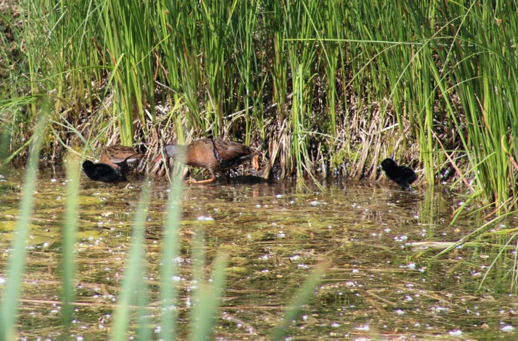
Virginia Rail, another Wyoming Species of Greatest Conservation Need, has been documented breeding in the Rafter J habitat mitigation area. These wetland specialists do not persist outside of intact wetland ecosystems, indicating the health and importance of the Rafter J habitat mitigation area.
If you’re interested in following the development of this issue, the next planning commission meeting is on January 8th! Please let us know if you have any questions or concerns about the process and we’ll answer them to the best of our ability. We are optimistic development can occur in a manner consistent with values outlined in our community’s Comprehensive Plan!
Mountain bluebirds are a cavity nesting species which rely mainly on holes in trees, often created by woodpeckers, to raise their young. This species of bluebird is believed to be on the decline in the West due to factors such as habitat loss and competition for limited cavity nests from invasive species like house sparrows and European starlings.
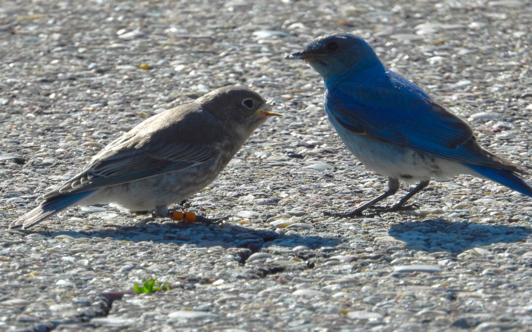
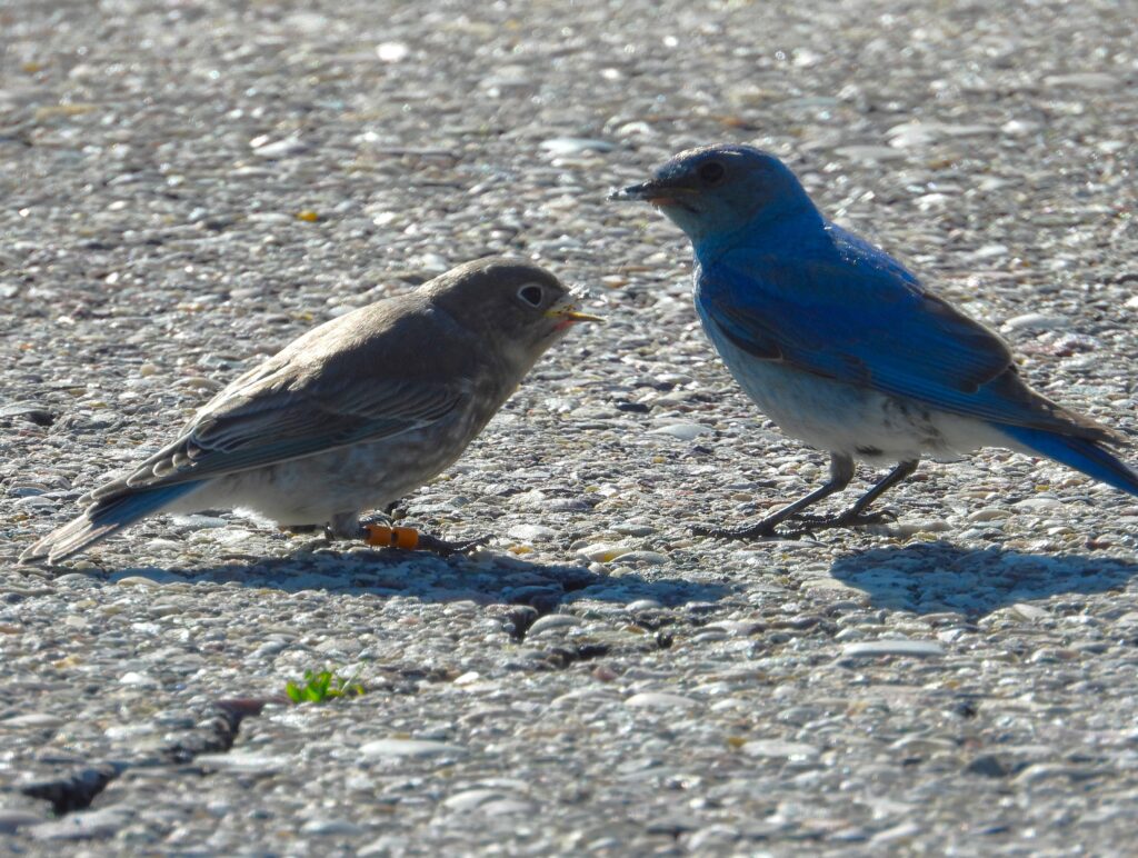
A fledgling bluebird from box 44 is fed by an adult on Monday at the Fish Hatchery. Photo Vicki Morgan.
Mountain bluebirds are among the first nesting songbirds to return to the Jackson Hole area each spring. There is likely some evolutionary strategy at play here; by returning when the ground is largely still snow covered bluebirds risk exposure to lack of food and cold temperatures, but gain an advantage over rival species when it comes to snagging limited nesting sites.
Our trail of volunteer-built nestboxes on the National Elk Refuge’s western boundary not only provides bluebirds with much needed nesting locations, but allows scientists a chance to gain a more complete understanding of the overall health of this sub-population.
How are the bluebirds faring this spring?
Overall, we’re confident 2023 has been a good year for bluebirds. While we won’t have a full dataset until the end of the summer, reports from our banding team and volunteers indicate bluebirds both returned to the trail and nested in relatively high numbers this spring.
While spring conditions imperiled some nestlings early in the season, wet conditions are likely to foster increased numbers of insects later in the summer which may benefit second rounds of nests. Photo: Vicki Morgan.
At one point, 16 active nests were recorded, more than were active over the entirety of last season. According to Lead Bird Bander Vicki Morgan, who surveys boxes and organizes volunteer data weekly, there are currently two to three boxes with nestlings about to fledge, and between four and six boxes where bluebirds are on their second attempts at nest building.
Several fledglings from box 44 were even “hanging out” at the Fish Hatchery parking lot, where they were being fed by their parents as of Monday morning (don’t all go to photograph them at once!).
The success of nestboxes this year can at least partially be attributed to last year’s batch of fledglings. At least four nest boxes contain female bluebirds which were banded last year as chicks. These birds migrated away last winter and have since completed successful return journeys back to the National Elk Refuge to build their own nests, usually within hundreds of meters from where they themselves hatched. The fancy phrase for this is “site fidelity.”
What are the challenges facing this year’s nesters?
Still, bluebirds on the nest box trail have faced challenges in 2023. While nest building jumped off to a quick start, insects were slow to emerge due to late-spring weather patterns and a handful of nests failed with a lack of available food for nestlings. While nest failure is a natural and normal process, it doesn’t mean it can’t be frustrating to witness young birds not make it, especially when you’re rooting for team bluebird! Several of our boxes have also experienced predation in recent weeks. Our best guess is that weasels are the culprit – snakes can also fit through nest box holes but generally devour young birds whole. Weasels on the other hand are prone to leaving behind “nestling bits” as evidence of their transgressions.
A 2023 fledgling with this year’s diagnostic color-band combination. Photo: Vicki Morgan
Are the nestboxes helpful for the birds?
We believe they are. Although not all nestling birds survive (you’re welcome weasels – for the buffet), the fact that many bluebirds do successfully fledge indicates the Mountain Bluebird Nestbox Project is likely having a net positive effect. Two years ago, a bird banded on our trail was recaptured and released in Texas during winter migration. And each year more and more “resights” of birds banded in previous years pour in. It’s going to take more than one productive year to help ensure the longevity of this species in our region, but that doesn’t mean we can’t get excited about this season’s results!
We want to give a final shout out to the 139 volunteers who joined us for our 14th annual Moose Day survey last month. As far as we know this was a record number of participants, as this Jackson Hole (and now Teton Valley) community tradition continues to grow!
In case you missed it, KHOL and Buckrail both reported on this year’s Moose Day. You can find the KHOL story here and the Buckrail story here.
In addition to these features, volunteer organizer France Clark shared her personalized post-Moose Day report with volunteers last week. Frances’s blog can be accessed here for those of you who didn’t receive it via email.
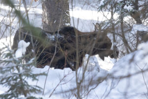
Moose in Cache Creek by Mitchell McClosky
While we won’t have official numbers until data is vetted and duplicated sightings are removed by the Wyoming Game and Fish Department, some highlights from the report include:
382 volunteer hours contributed to the survey
42 total survey areas covered
8 total Teton Valley, ID survey locations
As many as 113 moose sightings, roughly on par with what we’ve observed in previous years (note: expect this number to change slightly after observations are vetted)
Participation from two wildlife tour companies (Buffalo Roam and Ecotour Adventures)
13 participants on the Cache Creek “moose walk”
Anecdotally, the deep snow may have limited moose sightings in areas where moose are generally spotted.
There were no moose observed in Ditch Creek or around the airport. Moose were also not observed in the Town of Jackson. On the other hand, there were quite a few moose spotted along creek and river bottoms, including Cache Creek, the Snake River Corridor, and even Pacific Creek up north.
Final counts from 2021 and 2022 were 108 and 101, respectively, so we might expect this year’s count to be similar even if a few duplicate sightings are removed.
Alex Patia is a birder and naturalist who works for Teton Science Schools as a wildlife guide. He lives in Jackson with his husky, Mia.
It’s no secret that winter in Jackson Hole is harsh for wildlife. Many animals migrate out of the area to avoid the deep snow and frigid subzero temps that occur here. You likely know about some of our more charismatic mammals that tough out the winter here, like the elk and bighorn sheep on the National Elk Refuge, but many bird species also stay for the winter. If you don’t normally pay much attention to birds you could be forgiven for thinking that ravens and magpies are the only birds that stick around for winter, they are certainly some of the most abundant and conspicuous winter residents we have!
Even if you are looking for birds in winter you’ll likely only encounter 10-30 species in a day around Jackson. Given how hard it can be to find many birds in winter it may surprise you to find out that 80 species of birds can be found in Teton County, Wyoming every winter. I have put together a list of these 80 bird species and how likely you are to encounter them as well as a list of 40 additional species that have been documented in Teton County but do not normally occur most winters. In this post I want to tell you about some of these fascinating species, their adaptations for surviving the cold, and what you can do to help the birds!
I could tell you about all 80 species of birds that reside in Teton County, Wyoming for winter, but that would require writing a book, so instead I want to highlight some winter birds that can be found right in your backyard. Specifically, I am choosing to discuss birds that will readily come to check out bird feeders and offer nice views vs. species that hide in dense forests all winter. Ravens and Black-billed Magpies may be the easiest corvids to see but if you live in an area within or near forest you may be treated to other members of this bird family including Clark’s Nutcrackers, Steller’s Jays, and Canada Jays. These three corvids breed high in the mountains but in winter they will move to lower elevations and may even visit your bird feeders! In milder winters Jackson Hole can also get Blue Jays, very different from their cousin Steller’s Jays with paler blue backs, white underside, and no black crest.
Black-capped Chickadee by Alex Patia
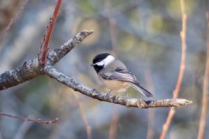
There are two families of small forest dwelling birds that are likely familiar because of how curious they can be around humans and how objectively cute they are: chickadees and nuthatches. Our two chickadee species are Black-capped and Mountain Chickadees, commonly seen year round but more often in small flocks in winter. Both have black heads and pale gray bodies but the Mountain Chickadee has a distinct white eyebrow that is slanted enough to give them an adorably angry expression. Black-capped Chickadees give the familiar “chicka-dee-dee-dee” call that is typically an alarm call to warn all small birds. The greater the danger the more “dee”s they will add. Nuthatches are skilled at climbing tree bark and will go in any direction, oftentimes going down headfirst or even hanging upside down. The Red-breasted Nuthatch is more common than it’s much larger cousin the White-breasted Nuthatch but both will readily visit feeders. These birds are well named because the best way to tell them apart is indeed the color of the breast.
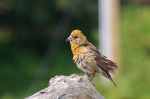
In much of the lower 48 states winter is the best time to see native sparrows at backyard bird feeders… but not in Jackson. Even the hardy sparrow Dark-eyed Junco, a sign of winter affectionately referred to as “snow birds” in the eastern US, only winter in small numbers here in Jackson Hole. But what we lack in sparrow diversity in winter we make up for with finches! Many of our winter finch species can be found year round here, but some like Black Rosy Finches, Evening Grosbeaks, and Pine Grosbeaks spend most of the year high in the Tetons and only descend to Jackson occasionally in winter. The most familiar and abundant backyard finches are House Finches and American Goldfinches, both of which are generally most commonly seen in town, especially in winter, as they do quite well in urban environments.
Cassin’s Finches look somewhat similar to House Finches but with a thinner bill, pink color on males, and thin crisp streaks rather than wide blurry streaks on the females. Pine Siskins, a smaller and less yellow cousin of the American Goldfinch, can form huge flocks in winter and will make themselves known with their loud “zeeeeeee” calls. Red Crossbills are common year round but unlike other finches they will rarely visit feeders, instead preferring to use their specialized bills to open the cones of specific conifer trees.
Bathing Red Crossbill by Alex Patia
Here in Jackson Hole we primarily have type 5 or Lodgepole Red Crossbills that have bills just the right size for opening Lodgepole pine cones. They will also feed on Douglas fir and Engelmann spruce cones. White-winged Crossbills are much more seldom seen, as they are a more irruptive species, meaning they may venture south or to lower elevations in huge flocks some years but will be notably absent other winters.
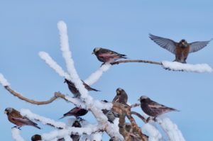
Evening Grosbeaks, a giant yellow finch with black wings and tail, are similarly irruptive and highly nomadic moving around throughout the winter. If you see Evening Grosbeaks in your yard count yourself lucky and savor the moment! Also highly nomadic are the Gray-crowned and Black Rosy Finches. Gray-crowned Rosy Finches are strictly a winter visitor to Jackson Hole as they breed in mountain ranges closer to the Pacific coast from the Sierra Nevada and north to the tundra of Alaska. Black Rosy Finches breed in the high alpine of a few isolated locations around the interior West including the Tetons.
Rosy Finches by Alex Patia
One adaptation Rosy Finches have for frigid nights is roosting in large communal flocks inside caves, rock crevices, barns, and old Cliff Swallow nests! Every couple of years Common Redpolls will appear, often among large flocks of Pine Siskins to which they look similar save for a stubby yellow bill, namesake red cap, and pinkish breast on males.
Lastly, if you are very very lucky you may have my favorite finch visit your yard: the Pine Grosbeak. This is a truly giant finch with bright red head and breast on males and a more subdued but still beautiful yellow head and gray body on females. Pine Grosbeaks spend most of their year in subalpine forests but will come to lower elevations in winter to visit feeders or like Cedar and Bohemian Waxwings they will feed on lingering fruit in hawthorns or ornamental cherry trees.
If you are wanting to attract birds to your yard and help improve their survival through the cold, harsh winter you only need three things: food, shelter, and water. You may think that you’ll need a heated birdbath to supply birds with an ice-free water source, but most birds will readily eat snow as a water source. So, you really only need two things: food and shelter. If you have any large native trees or dense shrubs you not only have shelter but also food in the form of hibernating insects in the bark and seeds in trees. You can supplement bird’s normal diet by putting out bird feeders but there are a few things you should consider with any bird feeder setup. If you’re not wanting to feed or attract rodents the feeders will need to be hanging from a pole more than ten feet from the nearest trees or branches and with a baffle or metal cone about halfway up the pole so rodents cannot climb up.
Red-breasted Nuthatch, a common visitor to backyard feeders, by Alex Patia
The feeders should also be high enough up that a bear cannot reach them, especially if you intend to feed the birds outside of winter. And for the sake of the bird’s health please, please clean your feeders! If you never clean your feeders birds will get sick as a result by spreading diseases like salmonella (usually spread by lethargic Pine Siskins) and conjunctivitis (spread by House Finches with swollen eyes) especially if bird droppings are allowed to accumulate.
There is a very easy way to avoid your feeders become ground zero for a bird pandemic though, simply use bleach water or hot soapy water to clean them (a brush with a long handle is great for getting inside the feeder), rinse thoroughly afterwards, and let them dry completely before placing back outside. Try to only put out enough birdseed that will get eaten in a week or less to minimize mold and bacteria growth on the food, and then you can simply clean the feeders between filling them. I recommend feeding nyjer, black oil sunflower seeds, and suet. Avoid seed mixes with milo and millet as most native birds don’t eat these, but rodents and invasive European Starlings and House Sparrows will! If you follow these tips your feeders should stay pest and disease free!
As you may know, the February challenge for Nature Mapping is to report finches. Because most finches are so irruptive with huge fluctuations in movements, range, and population size year-to-year any and all data on when and where they do occur can be incredibly useful to better understand their changing populations. Hopefully, with this list of common winter backyard birds you will feel confident in spotting and reporting the feathered friends visiting your backyard this winter.
As wildlife conservation professionals, we remind ourselves to celebrate the successes. Sometimes we get so wrapped into understanding and mitigating the challenges facing wildlife that we feel frustrated. In these moments, it is sometimes in our best interest, our community’s best interest, and the best interest of the ecosystem to also tally up and celebrate the successes we have achieved. By doing so, we rediscover the wind in our sails. By sharing our observations of our successes, we hope to provide inspiration for our colleagues and friends (all of you!) to continue your conservation efforts!
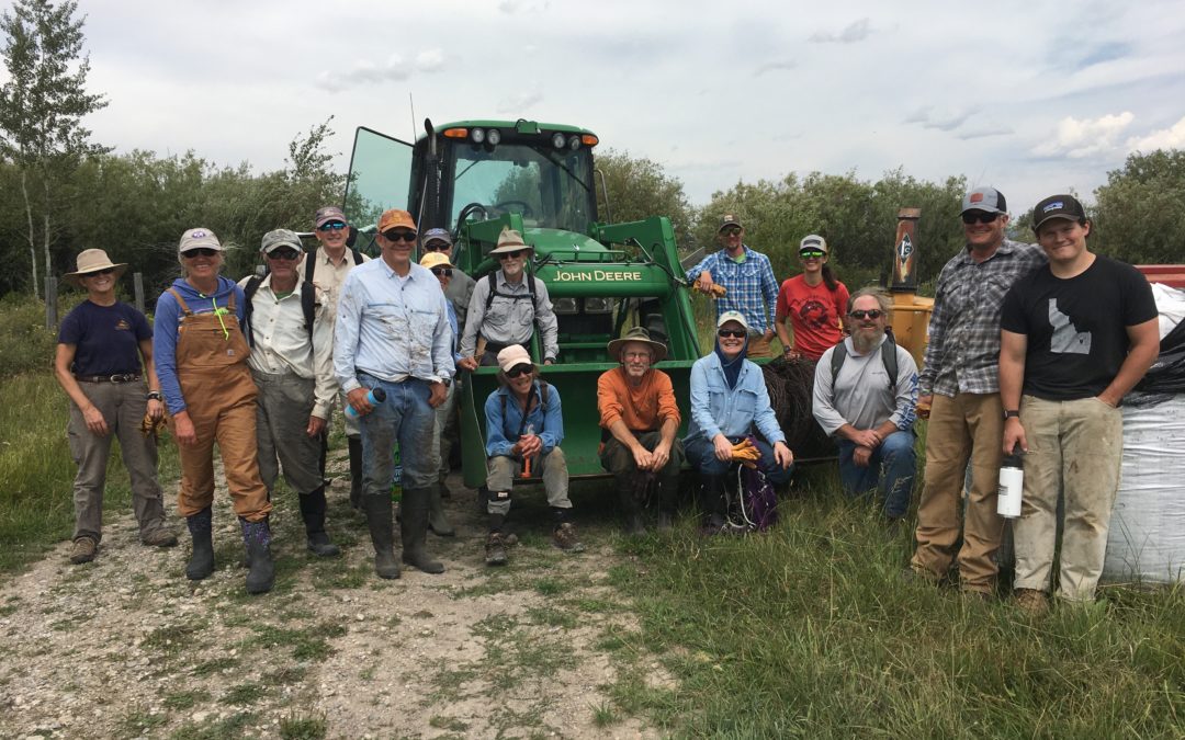
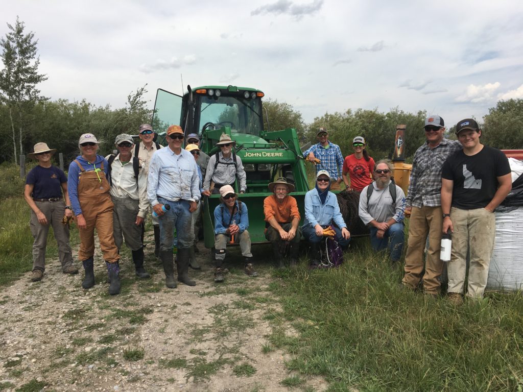
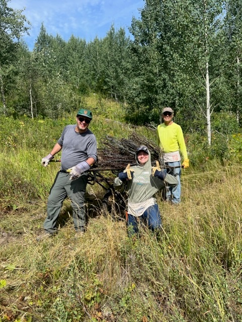
Volunteers after a successful fence pull in Teton Valley. We scheduled 8 public fence project this year, each taking plenty of time and effort to pull off!
We are happy to recognize a list of recent achievements that we and our colleagues have made happen. Did you follow the hard work that the County did to update the Wildlife Feeding Land Development Regulation (LDR) this spring? Did you know that the LDR does not include land in the Town of Jackson? Jackson manages wildlife feeding concerns separately from the County and they have embarked on discussions about their Wildlife Feeding Ordinance.
At a recent Town Council meeting, staff and Council members were unanimously in favor of improving the language in the ordinance to provide better security for bears and other wildlife. Councilman Rooks aptly summed up the sentiment in the meeting, “We are blessed to live in bear country and we need to act like it.” The Town will go through two more iterations of reviewing the ordinance language before they approve tighter restrictions on wildlife feeding, whether intentional or not.
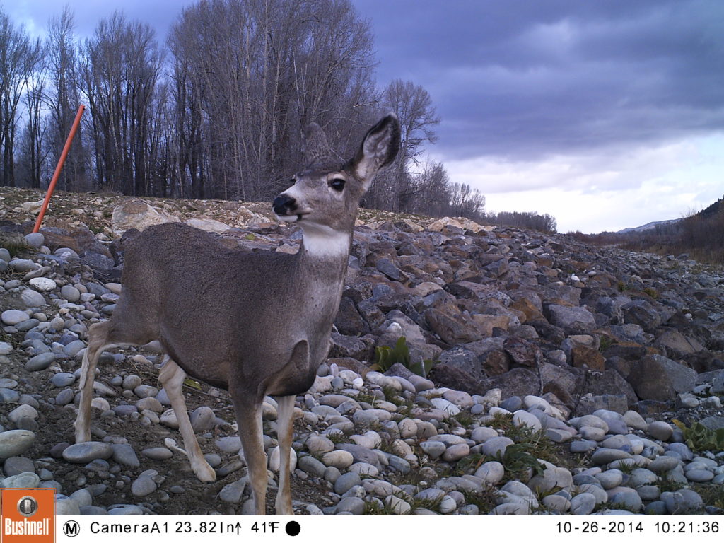
A mule deer uses one of our “levee ramps” to avoid dangerous riprap and access the river.
Do you remember when JHWF installed ‘wildlife ramps’ on the Snake River levee? That project fledged circa 2013 under the leadership of Greg Griffith with help from Gene Linn from the nearby Linn Ranch. The goal was to make it easier for all wildlife, but especially hooved animals, to access the river by giving them a path though riprap (large, uneven rocks) in which an ungulate could easily break a leg. Three ramps were built and trail cameras immediately captured images of elk, moose, deer, and even coyotes drawn to this new, preferred access to the Snake River.
This summer we worked the with Teton Conservation District to install additional wildlife ramps along the levee system near the Wilson Bridge. The additional ramps augmenting the impact of the existing ramps by increasing the number of easy access locations on the many miles of riprap along the levee Our trail cameras are currently in place, collecting images of wildlife using the ramps. We can’t wait to show you what we’ve found!
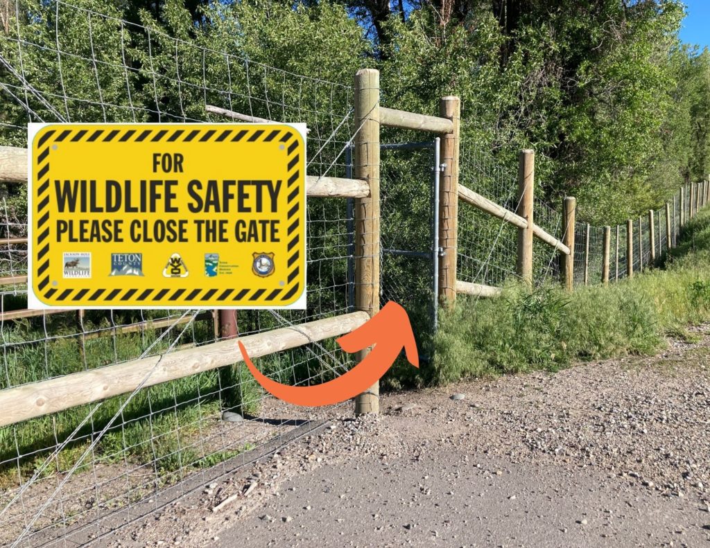
You can help keep wildlife off the highway by keeping the pedestrian gates closed!
Another win for wildlife in our community has been the system of exclusionary fencing and wildlife underpasses on S. Hwy 89, between Melody Ranch and Hoback Junction. Preliminary data has already shown a reduction in wildlife-vehicle collisions (especially involving mule deer) as animals are learning to use the underpasses to move beneath the roadway.
Last month, we worked with our partners at WYDOT, Teton Conservation District, Wyoming Game and Fish and Teton County to design, order, and install signage on the many pedestiran gates along this stretch of roadway. When these gates are accidentally left open, wildlife are able to access the highway instead of being funneled by the fencing to the underpasses. Ensuring the gates stay closed is important in order to allow the fencing and underpass system to do its job moving forward.
Of course, there are staffing successes to report too!
Charlie on the Mosquito Creek fence pull
We can’t say enough about the work ethic and positive attitude of our summer intern Charlie Brandin. Charlie played such an important role supporting our bird-banding team in action this summer. She also eagerly pitched in on several fence pulls and helped us collect data on existing fences in Grand Teton National Park as part of a major fence inventory project we’re undertaking with both the Park and Bridger-Teton National Forest.
While Charlie recently departed to begin her junior year of college on the East Coast, we are now looking forward to filling a new, full-time position of “BearWise Jackson Hole Program Manager.” This position will allow JHWF and our BearWise Jackson Hole partners to better address the persistence of human-bear conflict here in Teton County. Our goal is to have the new Program Manager out in the field helping to reduce conflicts by mid-November!
In recognition of all of this and more, won’t you join us in celebration?