By John Stephenson, Grand Teton National Park wildlife biologist
While people flock to Grand Teton National Park for its spectacular wildlife often hoping for a glimpse of an elusive wolf or grizzly, most visitors are all but guaranteed sightings of remarkable bird species in their travels. Birds are ubiquitous in the park across elevations, seasons, and habitats. Charged with preserving its natural resources, the park relies on partnerships and collaborators to gather invaluable data on the many sensitive bird species in need of conservation. The avian program at Grand Teton National Park operates with the support of other agencies, non-profit organizations, research partners, and a small crew of seasonal staff and volunteers. The birds of the park, like most other wildlife populations, venture beyond the park boundaries, and understanding and protecting these species requires extensive collaboration.
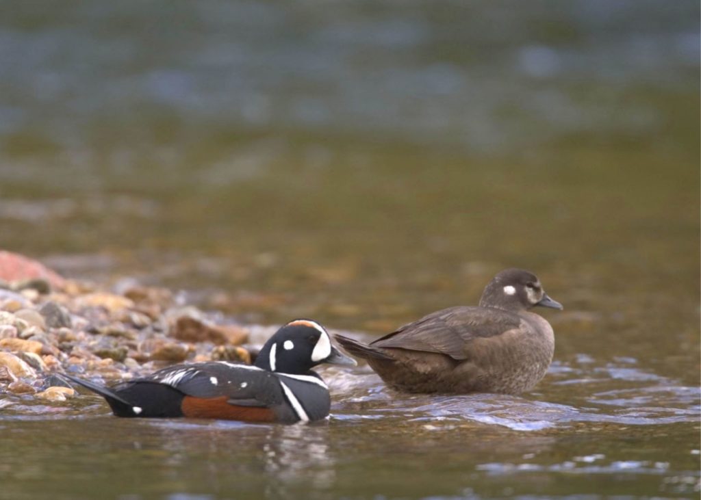
The Biodiversity Research Institute’s permit for Harlequin Ducks research is one of dozens granted for avian studies each year by Grand Teton National Park. Harlequin Ducks winter off the Pacific Coast, but a portion of the population migrates inland to breed each spring in turbulent headwater streams of the Greater Yellowstone region.
At Grand Teton National Park, we are fortunate to have an abundance of bird species and associated long-term datasets for sensitive populations. Notably, greater sage-grouse lek counts date back to the late 1940s and nest productivity data for bald eagles, trumpeter swans, and peregrine falcons were first recorded in the 1980s. For bald eagles and peregrines, annual nest monitoring originated due to their listing under the Endangered Species Act and tracking productivity of these species allows us to follow population trends. Data for other species, such as osprey and great blue herons, help us assess the health of important and often scarce habitats.
In the park, we celebrate the vast amount of protected habitat that is home to stable and healthy bird populations. When the potential for conflict with recreationists exists, the park establishes closures to protect nest sites. We follow seasonal and buffer distance guidelines from the US Fish and Wildlife Service to maintain compliance with the Migratory Bird Treaty Act. Most anglers and boaters are aware of the signed ½-mile no-stopping zones along the Snake River to protect occupied bald eagle nests throughout the summer. Similarly, a popular climbing route in the park has been seasonally closed for years to protect nesting peregrine falcons. In both cases, the public has supported and adhered to these closures which has helped the success of both species.
Resplendent scenery and world-class habitat preserved for mammals and birds alike, makes Grand Teton National Park as must-visit destination for wildlife enthusiasts.
While bald eagle, osprey, and peregrine populations have recovered and are stable within the park, other species are especially vulnerable. For species like greater sage-grouse, trumpeter swans, and common loons, the park participates in cooperative working groups comprised of many stakeholders all with the goal of conserving species on a regional scale across many jurisdictions. These working groups identify threats and causes for population declines and then provide recommendations to address concerns. For example, research has found that sage-grouse in Jackson Hole are limited by available winter habitat, and therefore, the local working group has promoted the preservation of sagebrush habitat and the restoration of the Antelope Flats Hayfields. With input from agency partners and the Wyoming Wetlands Society, regional efforts focus on protecting trumpeter swan nest sites and installing nest rafts to address sensitivity to human disturbance and fluctuating water levels. Common loons have also been helped in recent years by the collective expertise of Biodiversity Research Institute, the Ricketts Conservation Foundation, and our state and federal partners, resulting in the most known territorial pairs in the ecosystem since monitoring began in the late 1980s.
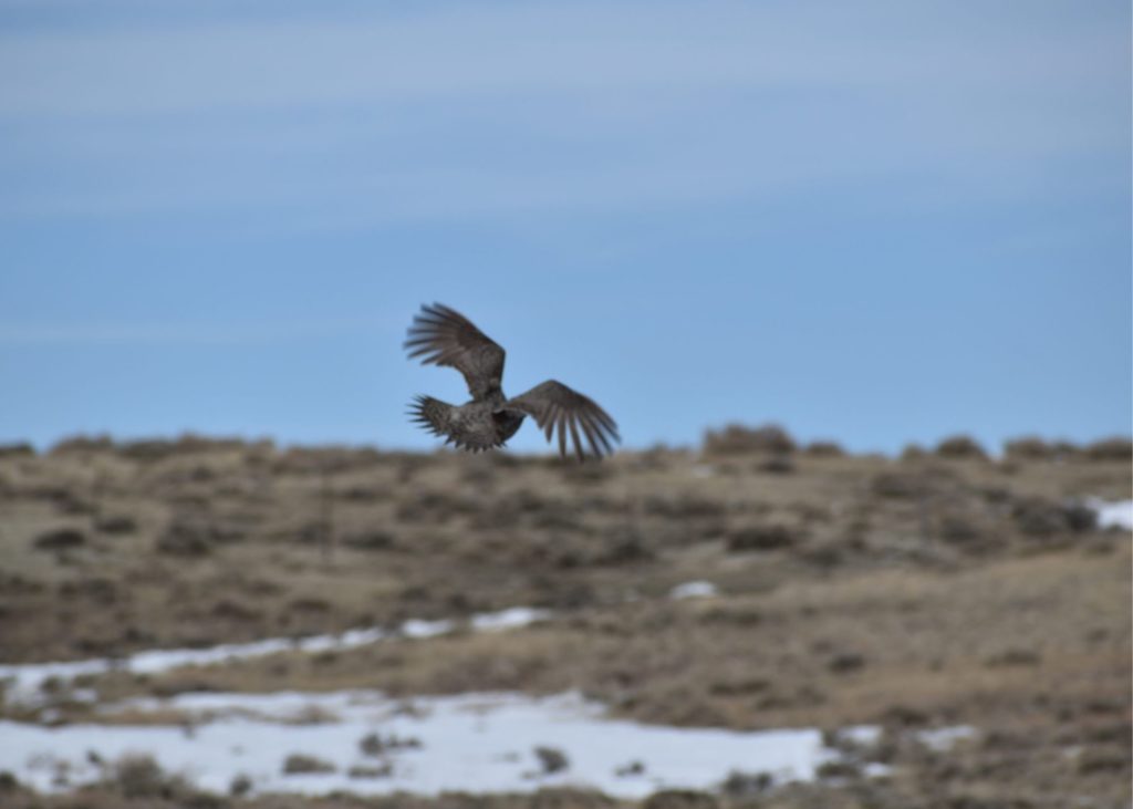
A Greater Sage Grouse takes to the wing against a Wyoming sky. The restoration of native vegetation to the Hayfields at Antelope Flats will ideally provide much needed habitat for this native range-fowl.
Additionally, we issue about a dozen bird-related research permits every year which increase our capacity to understand and ultimately preserve the birds that live in the park. Contributions from researchers working in cooperation with the park have identified migration routes and wintering areas for osprey (Craighead Beringia South), long-billed curlews (Boise State University), harlequin ducks (Biodiversity Research Institute), and rough-legged hawks (Craighead Beringia South and Teton Raptor Center); documented great gray owl and northern goshawk productivity (Teton Raptor Center); discovered a new sharp-tailed grouse lek (University of Wyoming); investigated songbird response to habitat restoration in Antelope Flats (University of Wyoming); surveyed for harlequin duck broods and yellow-billed cuckoos (Teton Conservation District), and documented the nesting ranges of Clark’s nutcracker (Cornell University) and black rosy-finch in the Tetons (University of Wyoming).
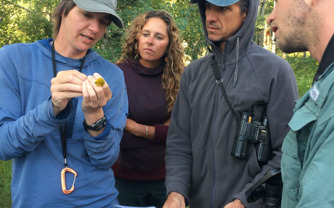
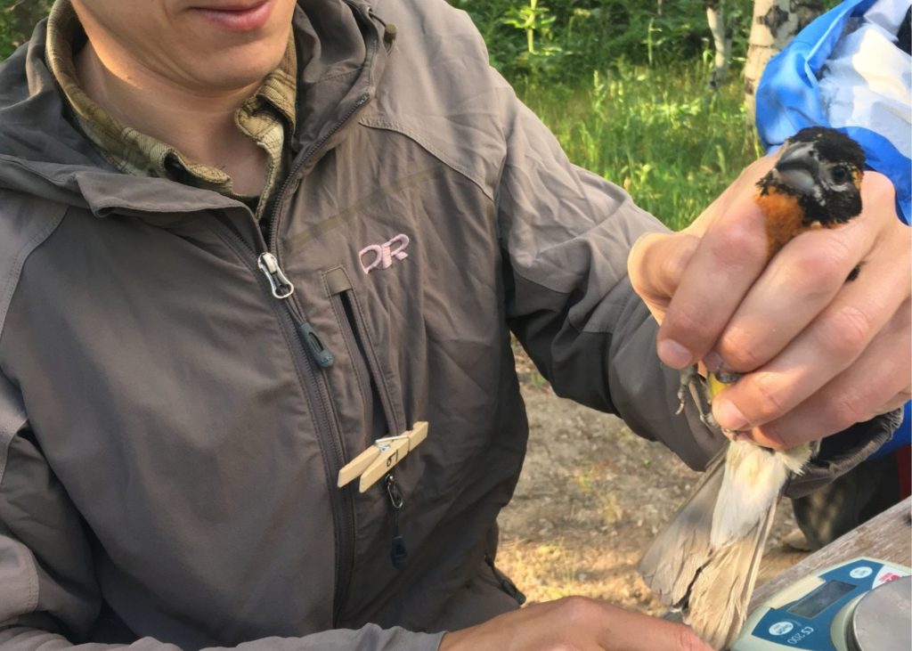
Another key project in the park is the Monitoring Avian Productivity and Survivorship (MAPS) bird banding station at the Kelly campus of the Teton Science Schools. This banding site has operated since 1991; is one of the ten longest running MAPS stations in the continent; and has stayed aloft with the generous support of the Teton Science Schools, the Teton Raptor Center, and the Jackson Hole Wildlife Foundation. This site contributes to the understanding of bird population trends throughout their range and has also provided key data locally. Of particular significance was the capture of a yellow-billed cuckoo in July 2000—the only confirmed observation in the park of this federally threatened species.
A professional bird-bander handles a Black-headed Grosbeak captured at the Monitoring Avian Productivity and Survivorship (MAPS) bird banding station at the Kelly campus of the Teton Science Schools. This banding site has operated since 1991 and is supported by Teton Science Schools, the Teton Raptor Center, and the Jackson Hole Wildlife Foundation.
The birds of Grand Teton have benefited from the interest, expertise, and time of collaborators and partners. Additionally, we value and solicit wildlife observations from the public. Millions of visitors travel through the park every year, drawn by the dramatic scenery and promise of seeing rare or charismatic wildlife. We welcome your reports of common loons, yellow-billed cuckoos, and forest raptors, among many others! From the bald eagle, our national symbol, to the western states’ iconic greater sage-grouse, birds highlight the importance of wild and protected land, the fragility of our natural world, and the power of collaboration.
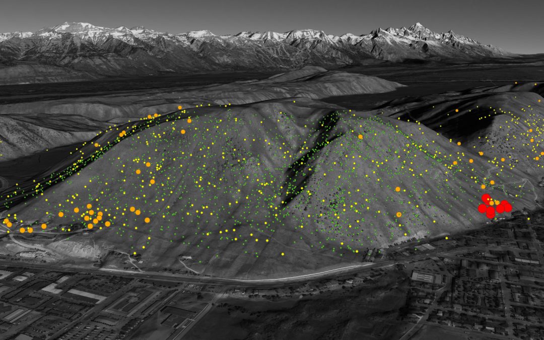
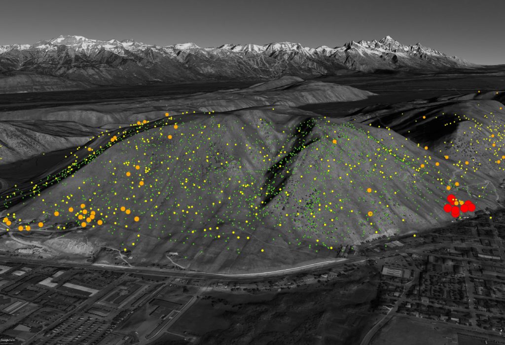
Growing up in Pennsylvania, I was not intimately familiar with the concept of winter range. Seasonal shifts were marked by hundreds of Canada geese gorging on leftover corn and soybeans. Over time more and more of those migrating geese became yearlong residents, displacing other waterfowl and depositing metric tons of green slipping hazards on sports fields…but that’s a different story. Winter range showed up on my radar in a big way during my first winter in Jackson in 2006. As part of a field technician position, I counted mule deer on winter range from 27 fixed locations around the valley twice a week. Over the following three winters, I listened to a lot of Trash and Treasure, documented 3,230 animals across 417 locations, and developed a greater appreciation for winter range. Monitoring conservation easements, conducting habitat inventories, and 15 seasons exploring public lands have deepened my understanding of why winter range is important.
Winter range mule deer observations above Broadway Avenue, symbolized by deer group size.
So, what’s winter range anyway and why should you care about it?
The lack of winter range is widely recognized as one of the most significant limiting factors to mule deer populations. Winter range is the topography, and habitat that mule deer require to survive deep snow, frigid temperatures, predation threats, and human-caused stress. The winter range we see animals using most frequently are the steep south-, east-, and west-facing buttes that receive enough sun and wind to keep snow depths low and natural high-fiber forage accessible, like mountain big sagebrush, Rocky Mountain juniper, antelope bitterbrush, rubber rabbitbrush, Wood’s rose, mountain snowberry, and curlleaf mountain mahogany. It also includes older, closed-canopy stands of Douglas fir and lodgepole pine that shield against heavy snow and cold wind.
When I was a young buck, my body mass could fluctuate by 15% over the year (mule deer bucks can lose 15% of their body mass during the rut alone!). A steady winter diet of beer, pizza, and Netflix transitioning to a summer diet of sunshine, water, and plants would typically put me at my heaviest in April and lightest in October. Mule deer are the opposite. Their fat levels may increase from around 9% in June to 25% in December. They then rely on those fat stores until May when the landscape begins to green up again. If they run out, their body will shift to burning protein/muscle (not good). A dog chasing a deer through deep snow has negative consequences―travel through snow can require 6x more energy than flat ground. What’s harder to reckon are the cumulative impacts of more frequent alertness, standing, and walking in response to humans and pets. Each act of avoidance is a debit on a deer’s fat stores. The best thing you can do is keep your dog under control and observe seasonal wildlife closures. Even if there isn’t snow on the ground, the deer appreciate the space to chill.
So, why we don’t just feed deer the same way we feed elk? There are plenty of biological, social, and behavioral reasons, but the simplest is that it can kill them. Mule deer have evolved to “stomach” our long winters. Deer are heavily reliant on rumen bacteria that adjust seasonally to the foods that are available on the landscape. By the time winter rolls around, a deer’s rumen has acclimated to handle high-fiber, low-protein food. Suddenly dumping high-protein or high-carb fuel like hay or corn in the tank is equivalent to putting gasoline in a diesel engine (also not good). If you want to provide food for wildlife, consider maintaining or restoring some of the native plants listed above in areas away from buildings and roads.
Organizations like Jackson Hole Wildlife Foundation play an invaluable role in amplifying the importance of crucial habitats like mule deer winter range. If you want to help, consider sharing some of the concepts of this post with friends or become a certified Nature Mapper and start logging observations of all sorts of critters on winter and other seasonal ranges. Morgan is the Geographic Information Systems (GIS) & Wildlife Specialist for Teton Conservation District. He is grateful for the opportunity to behold and share the hidden gems of the Greater Yellowstone Ecosystem with friends, family, and curious strangers. Follow along @morganser and @tetonconservation or send him notes or questions at morgan@tetonconservation.org.
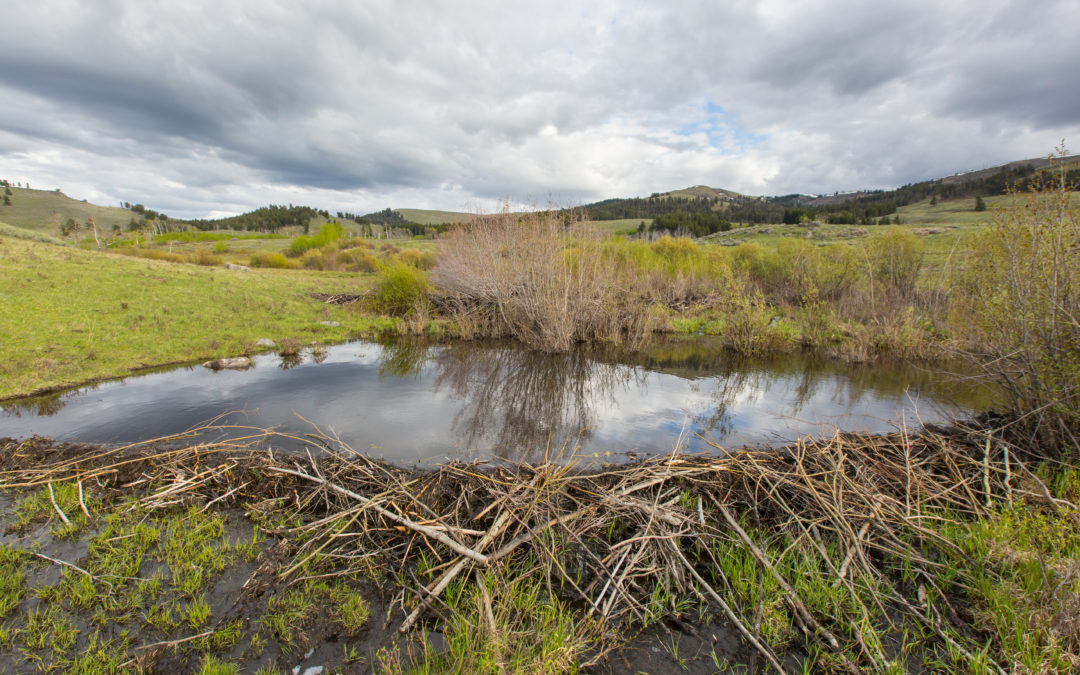
There’s been a growing appreciation of the important role beavers can play in creating and sustaining the ecological health of watersheds. As the former (now retired) director of the Wildlife Conservation Society Northern Rockies program, I oversaw a number of long term research efforts that helped establish that beavers, by way of their many activities, benefit a wide range of wildlife species native to the Greater Yellowstone Ecosystem. Migratory song birds and waterfowl, amphibians, moose, bears, and many more of our wildlife depend on healthy riparian and wetland habitats that beavers help to create and sustain. People as well are beneficiaries. The riparian and wetlands that beavers can help create and maintain filter out sediments and pollutants, reduce flash flood potential damage, and act as natural fire breaks, as well as providing some of our best scenery.
In parallel with this appreciation for the role that beavers can play, there’s been a deepening desire to see more beavers in our watersheds. The 19th and early 20th centuries witnessed the along complete decimation of many of our wildlife species, including beavers. Beavers have made some recovery, but best estimates are that the current population is less than 10 % of the likely original. This number is simply too small for beavers to fill the desired role as major watershed eco-engineers.
So we need them and want them but can we get them back in the numbers and locations needed? To do so we need to overcome two major challenges. First, for too long beavers have been viewed as nuisance animals, with little protection. Outreach and education efforts will be essential. For property owners, help them better understand the benefits of having an active, strong beaver population for themselves, their neighbors and their community AND that there are effective ways to substantially avoid potential property damage by beavers without removing beavers. For land and wildlife management agencies, beaver restoration must be a priority AND should be seen as an essential aspect of watershed habitat conservation and climate change adaptation. A number of organizations, such as Wyoming Wetlands, Wyoming Wildlife Advocates, and the Northern Rockies Conservation Cooperative are active on this front
The second challenge is more fundamental. Prior to my work with the Wildlife Conservation Society, I worked as research geologist studying the watersheds of the western U.S. It was through this work that I came to appreciate what a beneficial force beavers can be. But I also saw that as a result of the decimation of beaver populations, and a result of many poor watershed management actions, the watersheds of the West and the GYE cannot as they are now support the numbers beavers needed. Too many watershed channels are deeply incised, riparian zones if present at all have been reduced to narrow decadent bands alongside streams, and the water tables too depressed to support year round flows beavers need.
I am working to help tackle this second challenge. First, we need better information on beavers: where are they and what are they doing. In partnership with the Jackson Hole Wildlife Foundation, Grand Teton National Park and Bridger Teton National Forest, next spring I will start a citizen science effort to survey Grand Teton National Park and Bridger Teton National Forest: where are beavers now and what are they doing, and where have then been active in the not too distant past and what were they doing. Beavers leave telltale indications, and with training I will help citizen scientists learn how to identify, assess the age of (current, recent, near past and distant past), and map beaver sign. We will be using a beaver habitat model created by the Utah State University as a guide. This information will provide needed information on beaver habitat use now, as well as trends in habitat use during the past several decades (increasing, decreasing, shifting?). We will also identify where with some minimal actions, habitats could be improved to allow expansion of beavers into these areas of the watersheds.
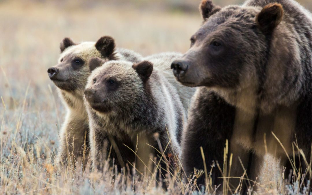
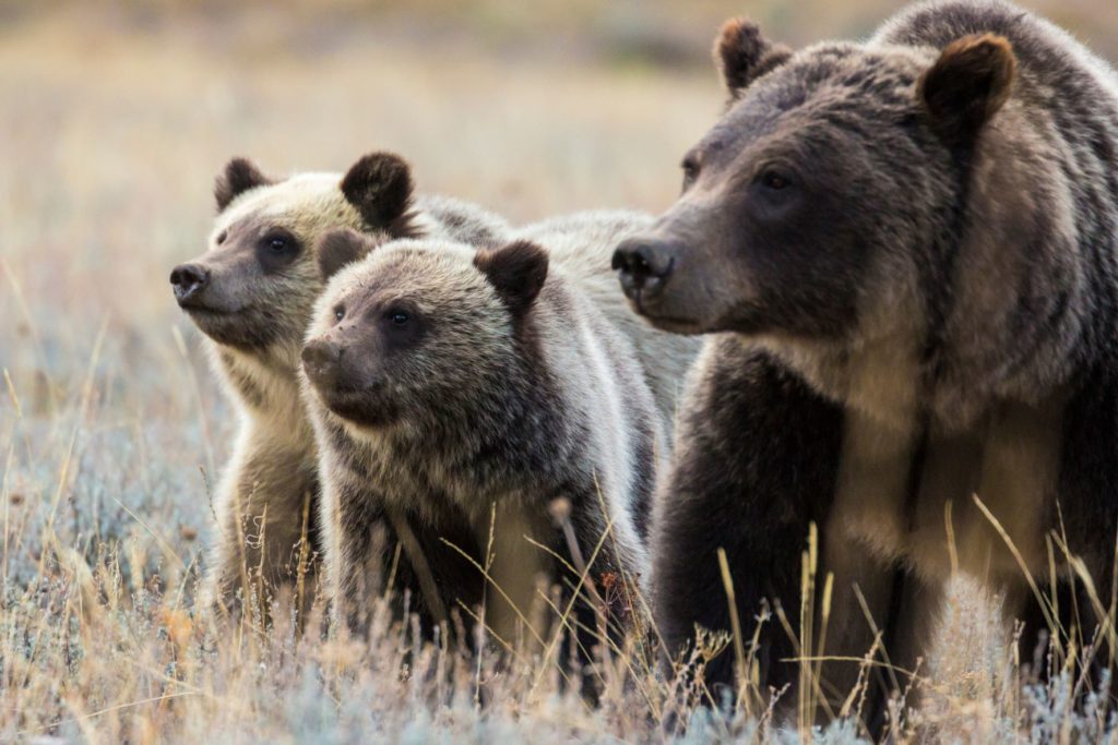
Holy cow. I am impressed at the boldness of bear 399. She is a survivor and is imparting this skill and resourcefulness on her four cubs. How did we get from the near extirpation of grizzly bears to bears walking through Jackson?
The incredible foresight of the Endangered Species Act has played a huge role in saving this incredibly charismatic and fascinating bruin. In our small community—a community that has broad impacts on both the Greater Yellowstone Ecosystem and the world audience as a whole—can we step up in the spirit of science-powered knowledge to protect our bears?
Grizzly 399 and cubs: Shutterstock image.
We’ve shown our love of our local moose through our willingness to spend millions of our dollars to protect them from cars and provide a permeable landscape. We adamantly protect our elk and deer by modifying and removing impediments such as fences on the landscape. We urge our elected officials to make decisions that reduce our carbon footprint. Can our community also take unified bear-wise actions to protect our beloved grizzlies such as removing our bird feeders, paying extra to bear-proof our waste, and while recreating, moving about the landscape is if we share it with wild creatures?
Science tells us that feeding wildlife leads to the un-wilding of those animals and often their death. Feeding wildlife can lead to increased incidence of disease spread (think social distancing) and draws animals into human-dominated areas where the potential for conflict is very high. Wild animals generally do not need our help, especially with food. They have evolved to fit specific niches and often have very specific diets. Human-provided food can kill animals directly. Deer, elk and moose experience great pain leading up to their death if they consume foods other than what they evolved to eat.
Human-fed wildlife often become habituated. A habituated animal may seem “tame”, but the problem is that they are not; they are simply willing to tolerate reduced spacing from humans in order to get food resources. This tolerance has a threshold and when that threshold is broken, it becomes a dangerous situation for nearby humans—whether it be the hand that feeds or a hapless passer-by. The reaction of the animal to its boundaries being breached often leads to that animal’s death by management decisions that are in place to protect humans from harm. At the least, our infringements on their space increase the release of stress hormones in their bodies, reducing their capacity to survive harsh winters and reproduce successfully.
I know I’m not saying anything earthshattering; you’ve likely heard all this before. But it’s worth reminding ourselves about the needs of wildlife and we are in a new juxtaposition: We are feeling a powerful pressure from being trapped in our homes or in our masks, all the while watching Jackson’s human population growth and visitation break records. Traffic jams and long lines; our favorite quiet places are not so quiet anymore. Imagine how the wildlife are managing. On top of the density of people, phenology is wacky; berries came in a whole month early this year. Fires are raging around the West; smoke fills our precious air.
Now more than ever, wildlife need a respite from our pressures. Give them space, let them gather natural resources and let them stay wild. Respect that this is also their Jackson Hole and they need their wild to stay wild.
Neighbors to Nature (N2N) is a community science project supported by the Jackson Hole Wildlife Foundation (JHWF) and our partners – The Nature Conservancy of Wyoming (TNC), Friends of Pathways (FOP), and the Bridger-Teton National Forest (BTNF). The four-way partnership launched N2N during the summer of 2018 to collect baseline data on wildlife, recreation use, and plant phenology in a popular recreation area near Jackson, WY. We maintain an array of 27 trail cameras throughout the Greater Snow King area, which includes the trail system from Game Creek to Cache Creek. We also collect incidental wildlife observations through Nature Mapping Jackson Hole, plant phenology data through Wildflower Watch, and recreation use through trail use counters in the project area. An important aspect of the N2N project is our engagement with the Jackson community, especially through volunteerism. Through this engagement we seek to expand public awareness of the issues which surround recreation and wildlife, as well as appreciation of the natural resources this area offers.
The N2N project is an example of how successful collaboration can be. Each partner organization leads an aspect of the project which fits their mission and provides staff time annually to help with tasks such as trail camera maintenance. Volunteer efforts are also essential to the success of the project. We rely on volunteers to classify trail camera images, collect wildlife and plant data, and assist with trail camera maintenance in the project area.
A volunteer arrives to service a camera
Trail camera maintenance is a relatively labor-intensive part of this project. It involves going to each of the 27 cameras and replacing SD cards and camera batteries so that data collection can continue. N2N is lucky to have a corps of volunteers who help us maintain our cameras. In addition to reducing staff time spent on the project, involving volunteers in trail camera maintenance allows community members to experience on-the-ground science firsthand. The volunteer experience gives the project more meaning to these individuals, as well as continuing education in ways that volunteers sometimes do not expect!
During the summer of 2021, N2N was lucky to have Leo Harland, Forest Dramis, and Tom Hargis assisting with N2N camera maintenance. These volunteers represent three generations of Jacksonites, each bringing a unique perspective to the project. They are avid outdoor recreationists who also value conservation, and the communion of these two things brought them to the project. They were kind enough to answer a series of questions about themselves and the project and their responses are summarized here.
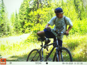
Leo Harland backpacking in Grand Teton National Park
Born and raised in Jackson, Leo Harland is an 18-year-old former Jackson Hole High School (JHHS) student. Among his many accomplishments in his young life are being a member of the back-to-back state championship soccer team for JHHS (2019 and 2021, with 2020 being cancelled) and recognition as “Student of the Season” by the Rotary Club in Feb of 2021. During his senior year, he led the championship soccer team as their captain. This summer, he worked at Jackson Hole Drug as a “Soda Jerk,” making milkshakes for customers who walk in from the nearby town square. He reports that it is “super busy the whole time, but is a solid job.” Not surprising for someone from Jackson, Leo loves skiing and spends as much time skiing as possible each winter. During the summer, he enjoys backpacking and hiking whenever he can carve time out of his busy schedule. He was introduced to Neighbors to Nature by TNC’s Trevor Bloom, who trained Leo on Wildflower Watch and trail camera maintenance in April of 2020. Leo started volunteering to gain community service hours as part of his membership in the National Honor Society, but his work morphed into an internship and in 2021, he helped with cameras independently when needed. Leo finds the N2N project valuable because it helps us understand how wildlife are distributed on the landscape, relative to human recreation activities, and how those activities might impact wildlife. While volunteering on the N2N project, Leo enjoyed learning about wildflower identification and study design, including the importance of random sampling. He also thinks it is awesome that, while he has never seen a mountain lion in the wild, the N2N cameras capture them somewhat regularly. Leo is now in Fort Collins where he will soon start his freshman year at Colorado State University. He plans to study Geology. After college, he hopes to get a job he loves, where he can work outside, doing something to help the environment. He summarizes his goals by saying, “I feel like it is wrong not to help save the planet…while I’m living here so I guess that is my goal.”
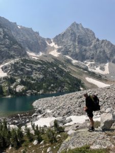
Forest Dramis enjoying the great outdoors
Forest Dramis co-owns Benchmark Builders LLC in Jackson. He is 47 and moved to Jackson after experiencing the Tetons during a backpacking trip in his 20’s. Forest’s passion in life is outdoor recreation. When he is not working, he can be found cycling, trail running, ski mountaineering, hiking, or backpacking. Among his notable achievements are solo running the Rim-to-Rim-to-Rim route in the Grand Canyon in a day (50 miles and 10,000ft elev. gain) and summiting Gannett Mountain (the highest peak in Wyoming) in a day. He is the Executive Director of the nonprofit he founded – JHCycling – and runs JHSkimo.org. Forest learned about the N2N project through his partner, Aly Courtemanch, and their good friend Kate Gersh (JHWF’s Associate Director) in May of 2021. He maintained a series of cameras on the Skyline, Sink or Swim, and Ferrins Trail areas during the summer of 2021. While performing camera maintenance, Forest encountered a variety of wildlife including mule deer with fawns and red-tailed hawks. Less enjoyable for Forest was learning that while capturing images of wildlife, N2N trail cameras also provide great habitat for spiders, which “do not appreciate having their homes disturbed.” When asked what his favorite part of volunteering on the N2N project is, Forest responded, “N2N allows me to spend time outdoors recreating while at the same time helping to inform others of the importance of the wildlife habitat that abuts the town.” Forest finds value in the project because he has seen the transformation of Jackson over the last 20 years to an “entity that prizes economy and tourist-dollars above wildlife and habitat.” He believes it is important to collect data that examine wildlife and recreation coexistence so the community of Jackson might be able to move toward making decisions that also benefit the wildlife we cherish.
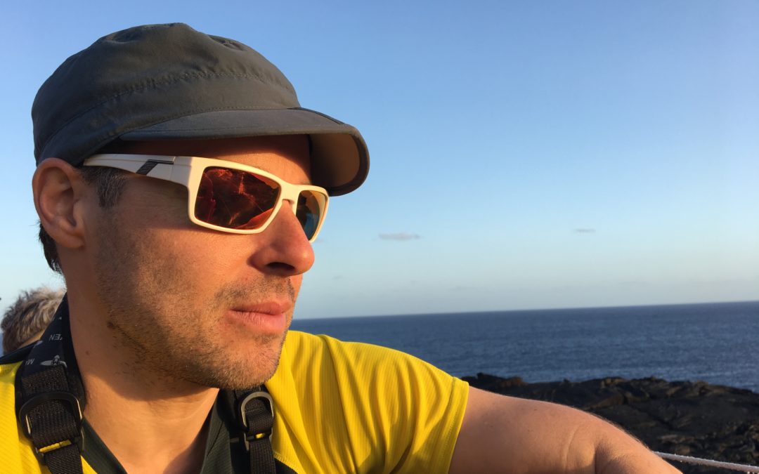
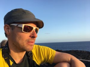
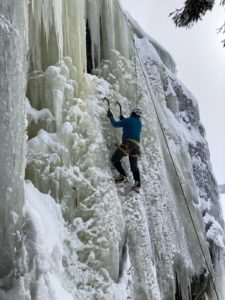
Tom Hargis ice climbing near Dubois, WY
Tom Hargis is an avid rock climber and mountaineer. He is 74 and has lived in Jackson for over 25 years. During most of that time, he worked for Exum Mountain Guides and has an impressive resume for mountaineering. He was a member of the first team to summit the Pakistani peak Gasherbrum IV via its northwestern ridge, and he is the only American to have accomplished that feat. Also in his portfolio are expeditions to Mt. Everest and Gasherbrum II. In 2004, Tom was awarded the Lifetime Achievement in Guiding Award by the American Mountain Guides Association. Tom now does carpentry work and teaches skiing at the Snow King Mountain Resort. While rock climbing in Wilson Canyon, Tom met Trevor Bloom, who introduced him to the N2N project. He thought volunteering for the project seemed like a good form of community service and was also curious to learn how frequently mountain lions and other wildlife use the Wilson Canyon Trails. His favorite part of volunteering on the N2N project is being outside, enjoying the wildflowers. Maintaining cameras for N2N gives him a good reason to get out for a hike and he sometimes sees peregrine falcons in Wilson Canyon. For Tom, N2N is valuable because it “allows for collecting hard data” and enables us to gain information on secretive species which are otherwise difficult to survey. According to Tom, “I’ve found that if you go hiking looking for mountain lions, the probability is low that you’ll see one. The cameras aren’t intimidating to the big cats, so it’s a good way to find out if they’re up there and how often they use that trail.” When asked what his plans for the future are, Tom responded in wisdom that he has “no particular plans beyond just enjoying life.”
It has been a pleasure for us to work with this crew of dedicated volunteers. Thanks to all JWHF volunteers for your work on our various projects. From fence projects to bluebird monitoring and camera maintenance, the JHWF would not be able to undertake as many conservation initiatives as it does without all of you! If you are interested in becoming a Neighbors to Nature volunteer, please contact Hilary@jhwildlife.org