Vehicle-Wildlife Collisions
Wildlife Doesn’t Know to Look Both Ways. But You Do!
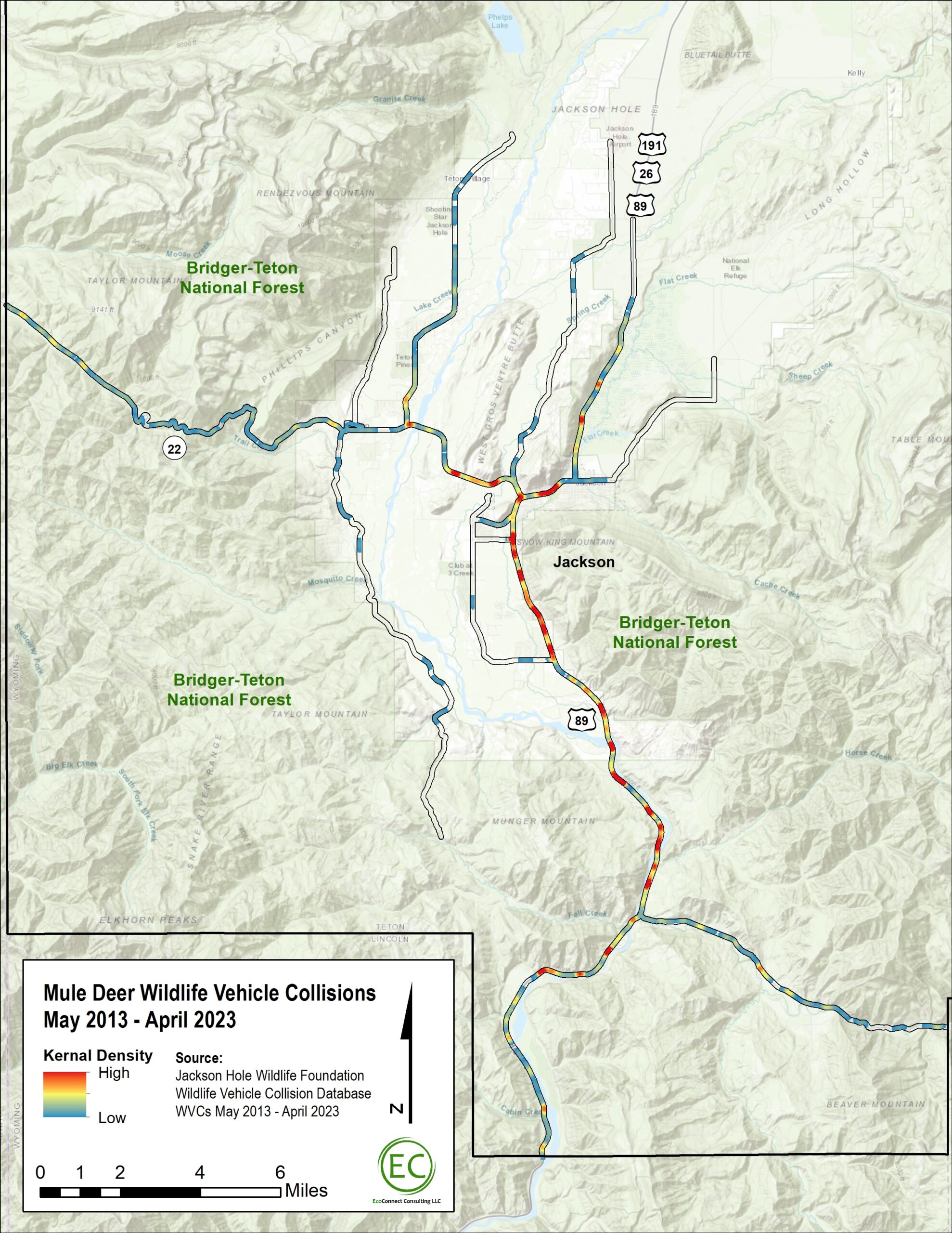
Wildlife-Vehicle Collision Hotspot Maps
The maps below indicate where wildlife-vehicle collisions involving elk, moose and deer most frequently occurred between 2011 and 2023. Roadkill data used for maps is a combination of Nature Mapping Jackson Hole observations and carcasses recorded by the Wyoming Department of Transportation and the Wyoming Game and Fish Department.
Due to exclusionary fencing and wildlife underpasses installed on S. Highway 89 between 2018 and 2022, collision hotspots between Hoback Junction and Rafter J likely reflect higher incidents—especially involving mule deer—prior to mitigation. Early data shows collisions on this stretch have dropped by at least 30% in recent years.
Other Ways to Report Roadkill:
If you do see roadkill, please call us at 307-739-0968, or email info@jhwildlife.org and report it. We would like to know as much as you can tell safely, such as where, when, what animal, what sex (if you can tell), and any other notes.
Jackson Hole Wildlife Foundation
Office Location:
25 S. Willow St., Suite 10
Jackson, WY 83001
Mailing Address:
PO Box 8042
Jackson, WY 83002
All rights reserved.
Privacy Policy


