Habitat Loss in the Snake River Corridor
Currently, the natural landscape of Jackson Hole is only 50% “built out.” This means that under current land development regulations, the footprint of homes, businesses and roads will effectively double in coming decades.
We urge a proactive approach. Not to prevent development, but to acknowledge its inevitability while working to maintain and improve habitat connectivity in the Snake River Corridor using the tools we have. This includes minimizing development of public land in key habitat, making roads and fence crossings safer for wildlife, and encouraging landowners to consider solutions like conservation easements when possible.
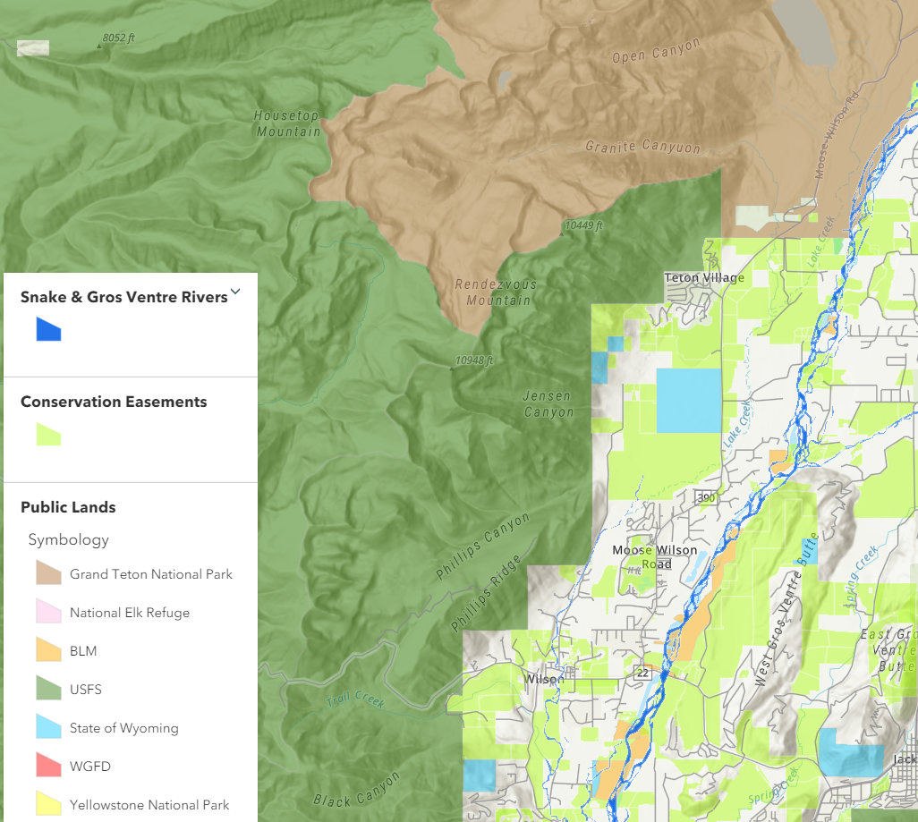
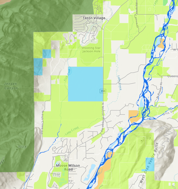
Case Study: State Land Sections
The State Land Section (large blue square) is almost completely surrounded by lands encumbered by Jackson Hole Land Trust conservation easements. The surrounding conservation easements likely contain low-density development rights. Nonetheless, in comparison to nearby residential development, the open space of these conservation easements and the State Section is significant.
- This State Section lies adjacent to a wildlife-vehicle collision hotspot on Highway 390, where elk and mule deer both have unsuccessful crossings.
- This section is used as summer habitat by wintering elk collared on the National Elk Refuge.
Land Use Changes
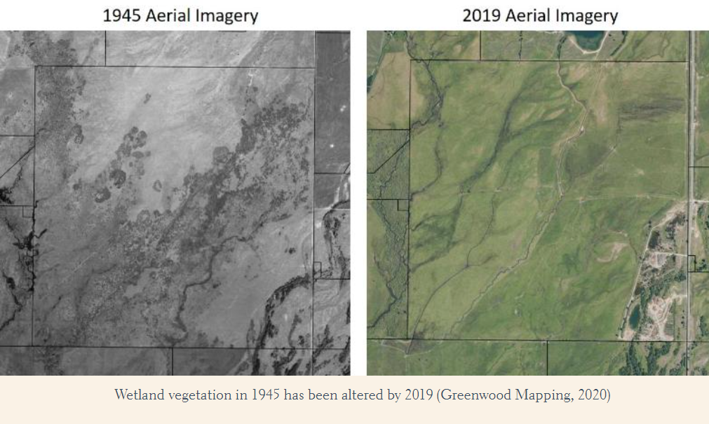
It’s important to realize that land use changes don’t always mean the construction of new buildings or roads. The land near the Wyoming State Section is primarily agricultural meadow with active irrigation operations and wetlands. Based on historic, aerial imagery, the wetland areas were more extensive in the past than found within the current agricultural operations.
This gradual loss of historic wetlands underscores the importance of safeguarding remaining intact habitat in the Snake River Corridor.